Dundrum Castle, County Down.

Thought to have been built around 1177, Dundrum Castle was part of the coastal defences controlling land routes from Drogheda to Downpatrick. Its just up a hill from the village centre of Dundrum and access is free (which is always great).  Dundrum is on the main road to Newcastle and if you wanted to kill two birds with one stone it has a decent car boot sale on Sundays but its better when the weather is good (summer being best of course).

dundrum castle (29)

On the morning I arrived there was a pretty thick fog hanging over Dundrum Bay below the castle, but because it sits on a hill you could actually see over the top of the fog. You can see the town church spire poking up through the mist here.

Parts of the castle ruins look more like parts of an old house but I think there were numerous additions to the original castle down the centuries.  As the fog started to burn off I got some nice pictures of the place.

The tower set at the back of the castle grounds. The second picture shows the view through one of the windows of the tower over Dundrum Bay below.

dundrum castle (24)

The castle wall remains.

dundrum castle (58)

There are some woods to the left hand side of the castle (known as Castle Woods) that have a nice walking trail through them (seen just behind the fence here). The woods were planted nearly 200yrs ago and some information on them can be found here if youre interested: http://www.walkni.com/walks/382/dundrum-castle-woods-trail/ I had a great little morning (which as you can see turned out really beautiful) and an early visit like this (my first time) was certainly worth the trip.


Larrybane, Game of Thrones Location, Co.Antrim.

I took a drive up to a place called Larrybane yesterday which is halfway between Ballintoy (another GoT location, see my posts on it) and Carrick-a-Rede rope bridge. In fact to get there you have to follow the signs for Carrick-a-Rede and park up in one of the two car parks when you arrive (the first one you come to is for the bridge but theres a another one lower down thats better for Larrybane). The good thing is, Larrybane is completely free to access (the bridge is a pricey £7.50 each but hey, we all know by now that the National Trust is very good at robbing tourists eh? We’ve all become aware of their dodgy Giants Causeway shenanigans) and its really worth investigating – especially if youre a Game of Thrones fan and youve just visited Ballintoy mere minutes away. Larrybane was once a busy old limestone quarry and you can still see the remnants of the works buildings there.  

If you look at the top left corner of the first picture you can see the Game of Thrones set location at Larrybane. And in the second picture the same location yesterday with just my car parked there haha. This site was where Brienne of Tarth was first introduced to the show back in Season 2 (I think).

larrybane (4)

Theres a huge sweeping bay below the old quarry at Larrybane and you can actually see the point in the far distance where Carrick-A-Rede rope bridge spans the gap in the cliffs if you look very closely. Its that V shaped cut in the rocks just left of center towards the back of the picture. I have included a close up of it I took below.

larrybane (6)

Some of the old quarry ruins that remain. Looking pretty ominous against the cloudy November sky.

The view from the top of the headland is pretty spectacular I must say. It was a reasonably overcast day but some parts of the sandy bottom of the sea were a stunning turquoise blue. The island you see in the first picture is known as Sheep Island. I didnt see any sheep on it (theyd have to be able to swim to get out there) but it has some old folklore history yet its now designated as an area of special scientific interest and human access is prohibited during bird nesting season.

larrybane (2)

If you take one of the small trails through the grass at the top of the headland and look over the other side (be careful!), this is the view youll see. Its just as amazing as looking in the other direction and you might just be able to spot Ballintoy Church (which sits at the top of the road down to Ballintoy harbour) near the middle of the picture.

larrybane (8)

This was taken right down at the bottom of the cliffs (theres a crumbling old road to walk down) where the rubble and fallen limestone rocks from the quarry festoon the shoreline. You can see Sheep Island again in the background and I expect there may be some fossil hunting to be done down here at low tide.

larrybane (7)

This is a zoom in to the V shaped cut I mentioned in the rocks (on the second picture) where Carrick-A-Rede rope bridge crosses over the gap. You should actually be able to see the people crossing it. Its a bit of a walk to get to the bridge and once you do it youd likely not go again, but the walk there has everyone looking back towards Larrybane as the view behind you is so stunning. Personally I enjoyed visiting Larrybane (FREE!) just as much as the bridge. And it didnt have hordes of tourist bus passengers either walking in file to get there 😀


North Coast Dreams (video) Slideshow of the Causeway Coast County Antrim.

Ive created a little slideshow video here of several pictures Ive taken around the North Antrim coastline. Its my first attempt at this so forgive its amateurish limitations. Locations seen include Castlerock, Binevenagh, Portrush, Portstewart, Dunseverick, Port Moon, Gortmore, White Rocks, and a glimpse of Dunluce Castle.


Port Moon, County Antrim, Causeway Coast

A while ago I posted some pictures taken at Dunseverick Grasslands which involved climbing over the wall at the Dunseverick Castle layby and walking right around the headland there. Its a truly stunning walk and one thats hidden from the road so it can only be accessed on foot. There is another walk in the opposite direction however which is just as amazing towards a magical little bay called Port Moon.

moon-1

Port Moon has a long history of fishing going back well over 200 years and from 1830 nets were attached to the rocks offshore to catch Atlantic salmon on their journey to the river Bush for spawning. Crabs, lobsters and kelp were also harvested here.

moon-2

One of the crags jutting out into the sea on the walk to Port Moon, clearly showing the hexagonal columns which cover this area very close to the Giants Causeway (less than 5mls away).

moon-3 moon-4

Your first views of the little “Fish House” bothy seen from several hundred feet above Port Moon bay (and yes, you can climb down there if youre brave enough).

moon-6 moon-5

The surrounding area is simply stunning.

moon-7

After climbing down the looping path to the bottom of the cliff (it looks much more scary than it actually is, but be careful if its been raining as it can be slippery) you arrive at the old Fish house which now operates as a bothy (a small hut or cottage used as a refuge) which you can arrange to stay at if youre feeling adventurous (see here: http://www.canoeni.com/canoe-trails/north-coast-sea-kayak-trail/access-point/port-moon/ ). The building used to house all fishing operations at Port Moon but had fallen into disrepair until it was resurrected as a bothy in 2011. There are some pictures of the inside here https://www.hikersblog.co.uk/an-overnight-stay-in-port-moon-bothy/ but normally its locked.

moon-9 moon-8

Looking out across the bay from the Port Moon shore. Not bad for a wintery February morning!

moon-10

The bothy seen from the opposite side of the crescent shaped (moon shaped) bay.

moon-11 moon-12

Port Moon, a magical little place now deserted and haunted by the ghosts of its fishing past. Its really worth seeing and its very much an undiscovered gem of NI that most residents wont even have seen. Dunseverick Castle may not be much to look at but once over that wall and walking either left or right youll surely be impressed.


Portmuck Islandmagee County Antrim

Islandmagee is a peninsula on the east coast of Co.Antrim and in many ways its often disregarded by many in Northern Ireland given that its off the beaten path. Its very much a rural community there although it does house Ballylumford power station which provides Northern Ireland with half its electricity, but hidden away at the north eastern tip of Islandmagee lies Portmuck which really is worth a visit.

Portmuck doesn’t get its name from its hygienic condition, but rather from the old Irish word for pig which was “muc” therefore the label actually means harbour of pigs. A long time ago the area had a roaring trade in cattle, horses, and pigs so it looks like the swine managed to give the place its name (though some say its because the island off shore here looks like a sleeping pig but its open to question). The island is known simply as The Isle of Muck (lol) which was once a hiding place for horses when they were being smuggled across from Scotland by those wishing to avoid excise or having them taken away.  It was also a retreat for a few scamps on the run from the law.


portmuck-2

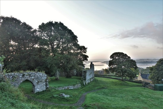
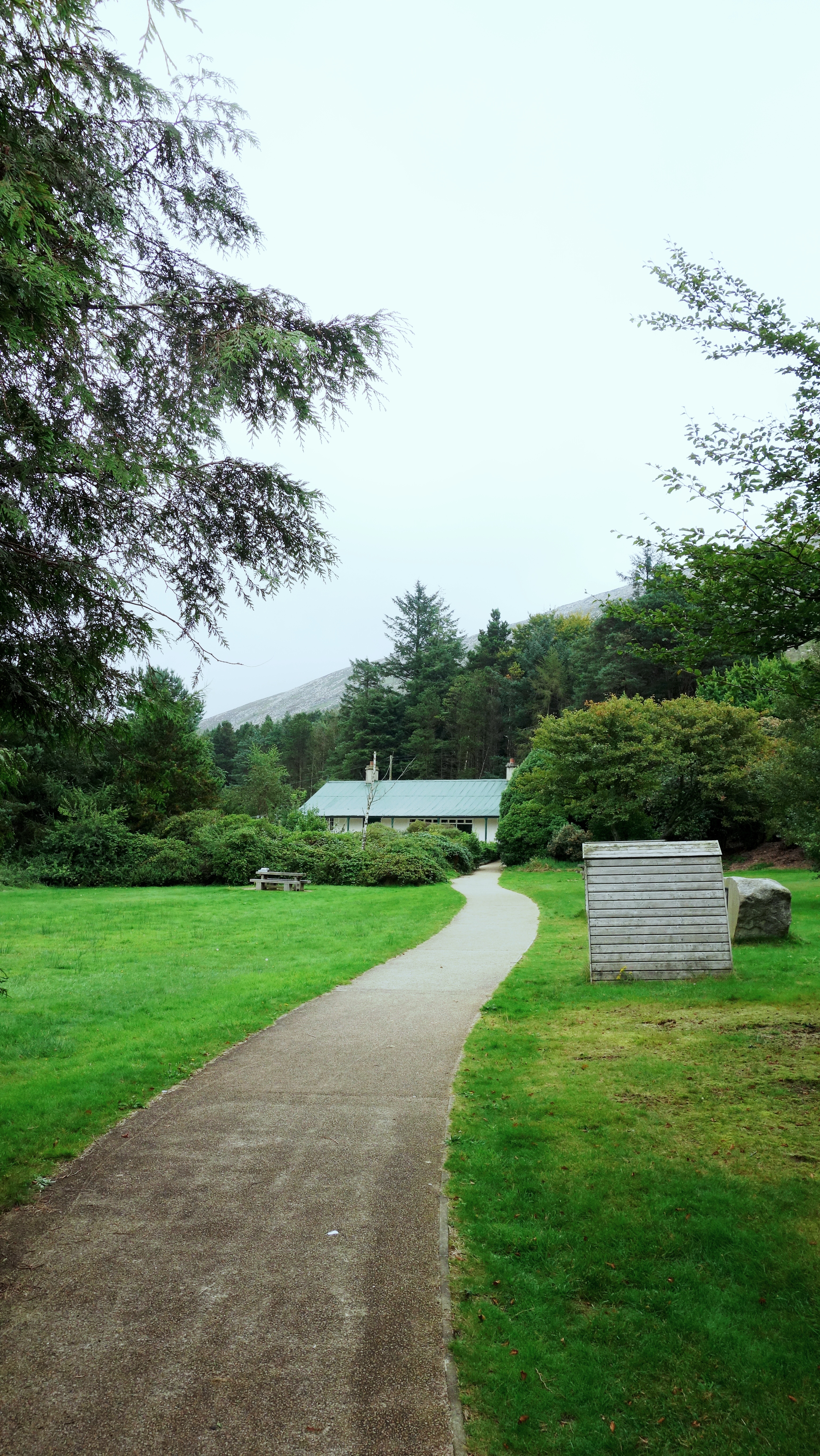
Some information you will see on arriving at the car park in Portmuck. You can read some notes about the history of the place and there are toilets and useful picnic benches nearby.


dsc08937dsc08936

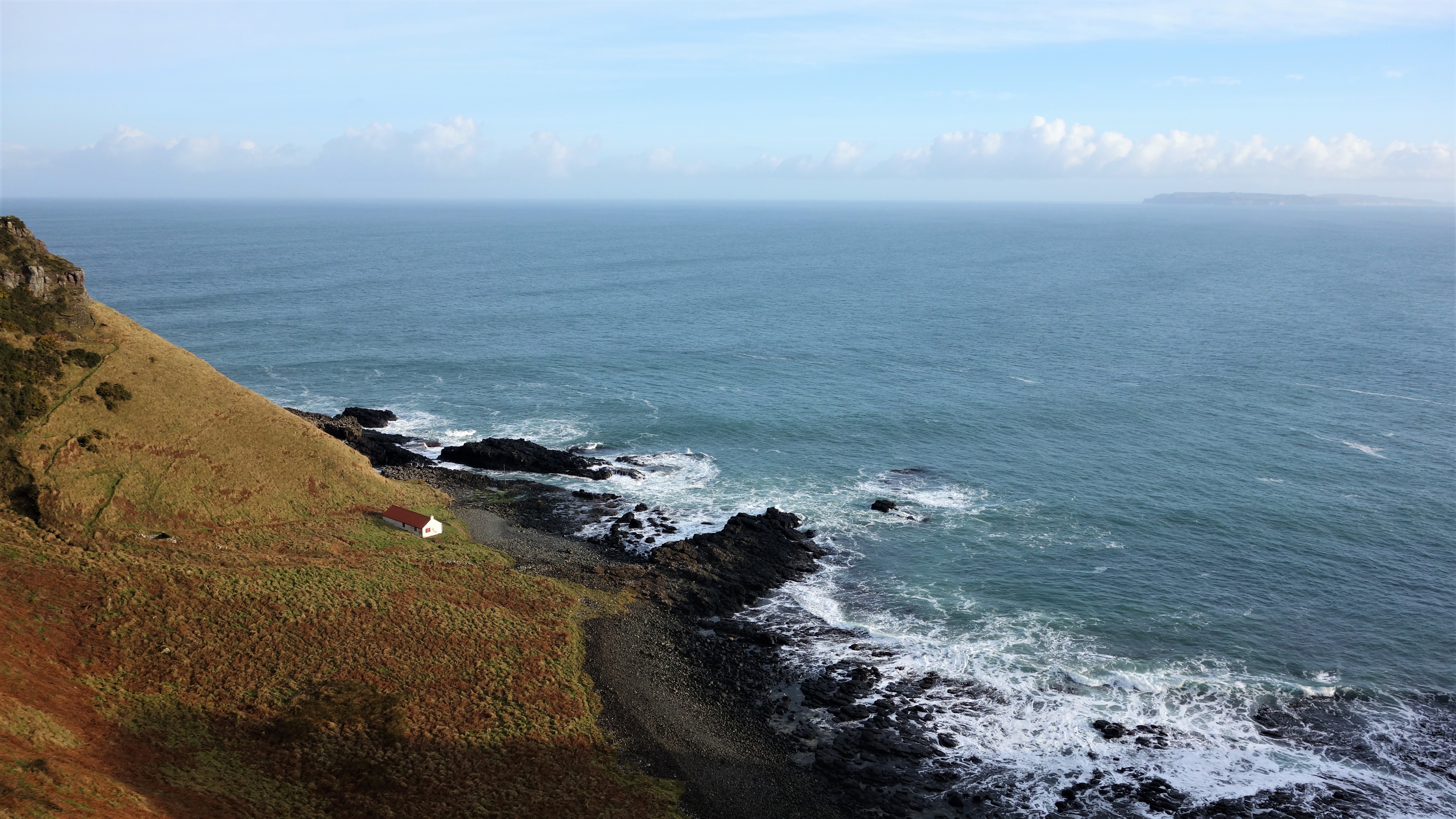
The little beach at Portmuck and a view taken from the right side hill looking down on the harbour. Really very tranquil and peaceful.


dsc08922

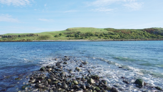
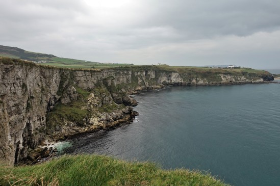
From the hill top overlooking Portmuck bay you can see The Isle of Muck (not to be confused with an island of the same name in Scotland) which today provides the third largest nature reserve for birds in Northern Ireland including kittiwake, guillemot, fulmar and razorbill with peregrine falcons commonly hunting over the island. You can catch sight of puffins, otters, common and grey seals and porpoises offshore too. The only way on to the island is by approaching from the land facing side (seen here).


portmuck-11

From the hill top you should see some wooden steps to take you down to the rocks below. I highly recommend you go down. Once there, walk right along the shore until you come to this beautiful white stoned beach. The water is stunningly clear as you look across to the island.

portmuck-10

Made up of mostly limestone pebbles (limestone is quite common along many shoreline parts of Co.Antrim) the beach here is hidden behind the headland at Portmuck and you wont see it unless you go look for it. Many of these stones will contain fossils and you can find them relatively easily if you know what to look for (just like Whitepark Bay https://niviews.com/2015/02/18/whitepark-bay-north-coast-county-antrim/ )

dsc08928

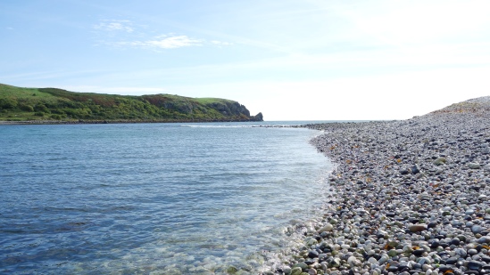
The limestone beach in bright sunlight really glows and the camera probably hasn’t done it justice here. You might be able to see a line in the water cutting across to the island which is actually a causeway that can be used to walk over at very low tide. I don’t know anyone who’s done it but the old picture here (not mine) clearly shows that its possible when the tide drops low enough: https://i.imgsafe.org/1452c6cf49.jpg its also said that livestock (many years ago) where brought to and from the island this way. I have to say however, I think it looks a lot more beautiful when the causeway is covered by the sea.

dsc08931

The edge of the causeway.


portmuck-14

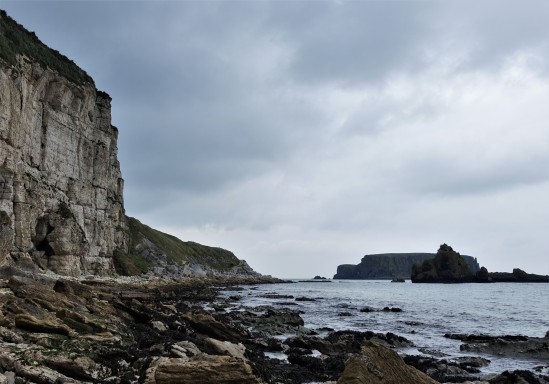
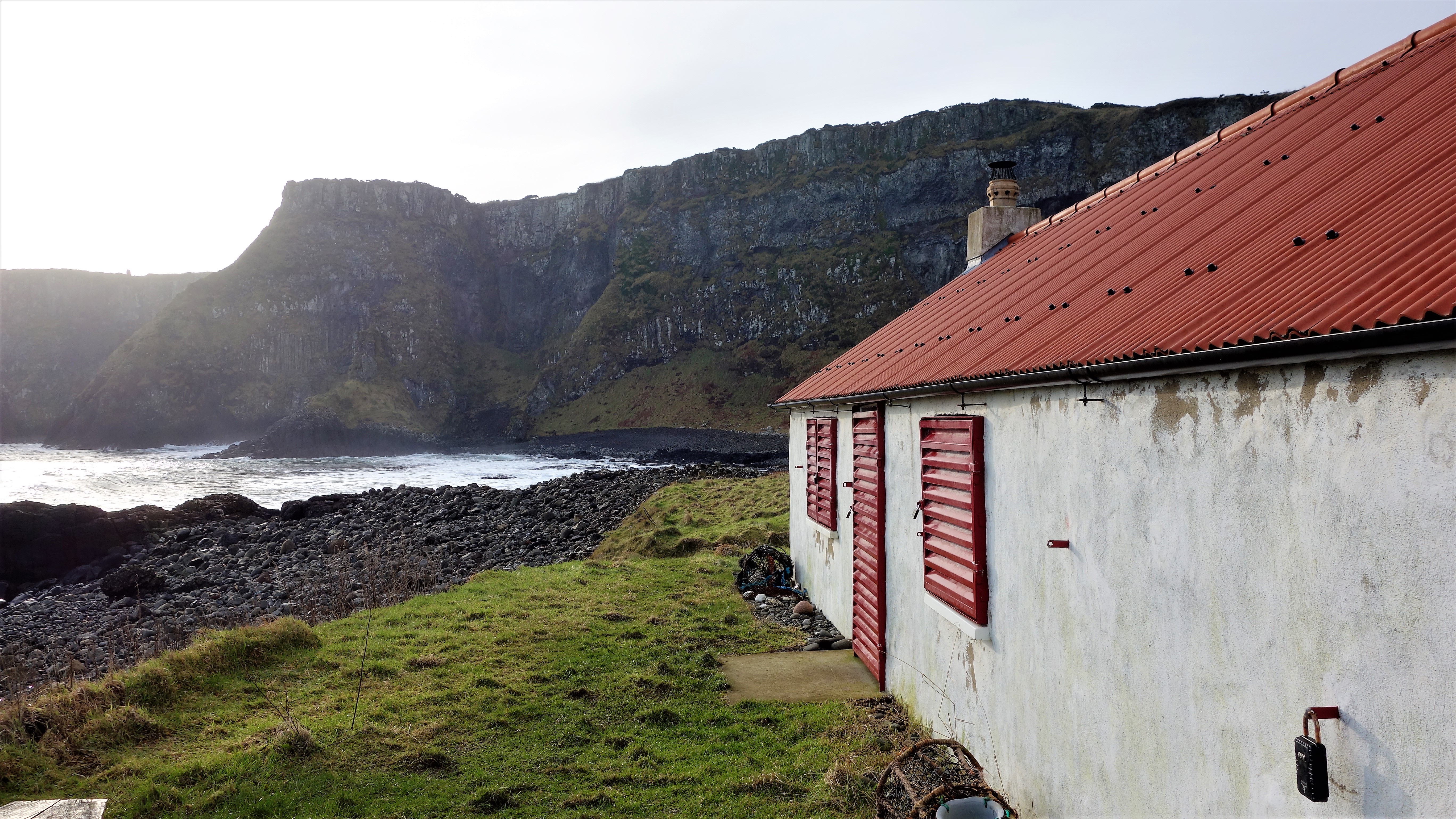
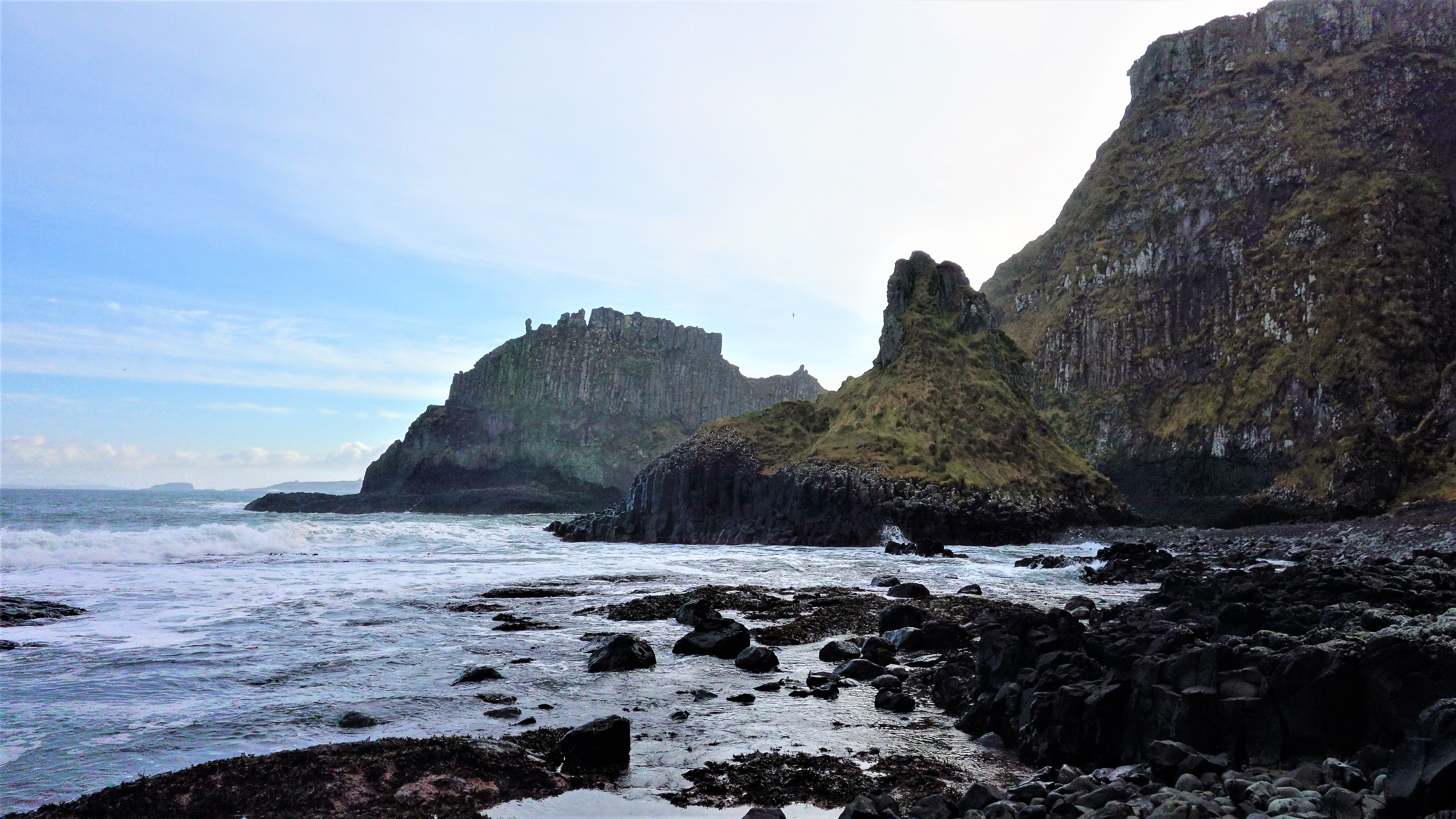
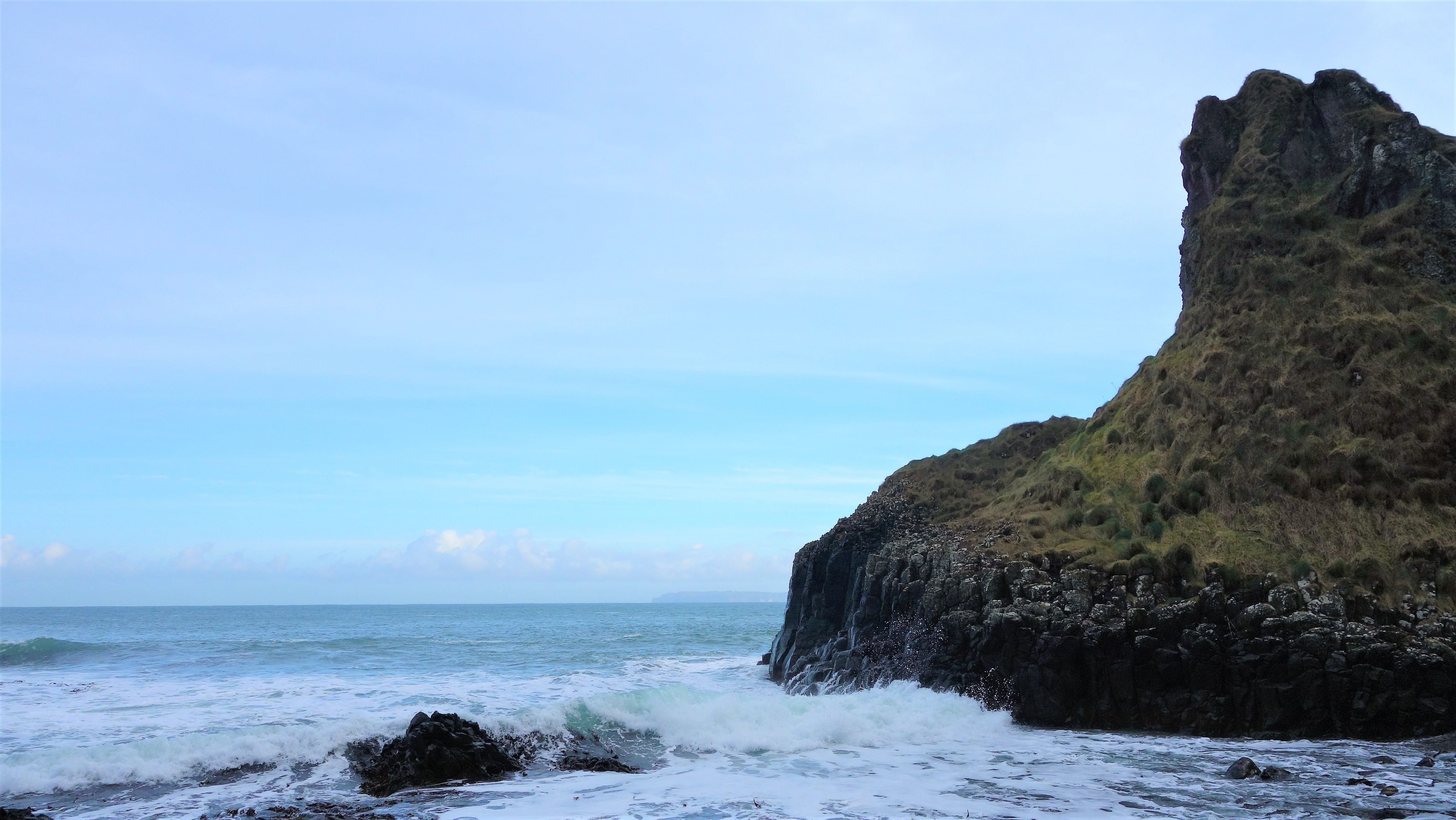
Just beyond the beach lies some huge green cliffs which Ive read contains a two mouthed cave that may be accessible at low tide. Sadly this was as far as I could go today though.

dsc08941

At the left side of the beach there’s a small gate that allows you access to walking a path high above Portmuck Bay (marked by this sign).


dsc08961

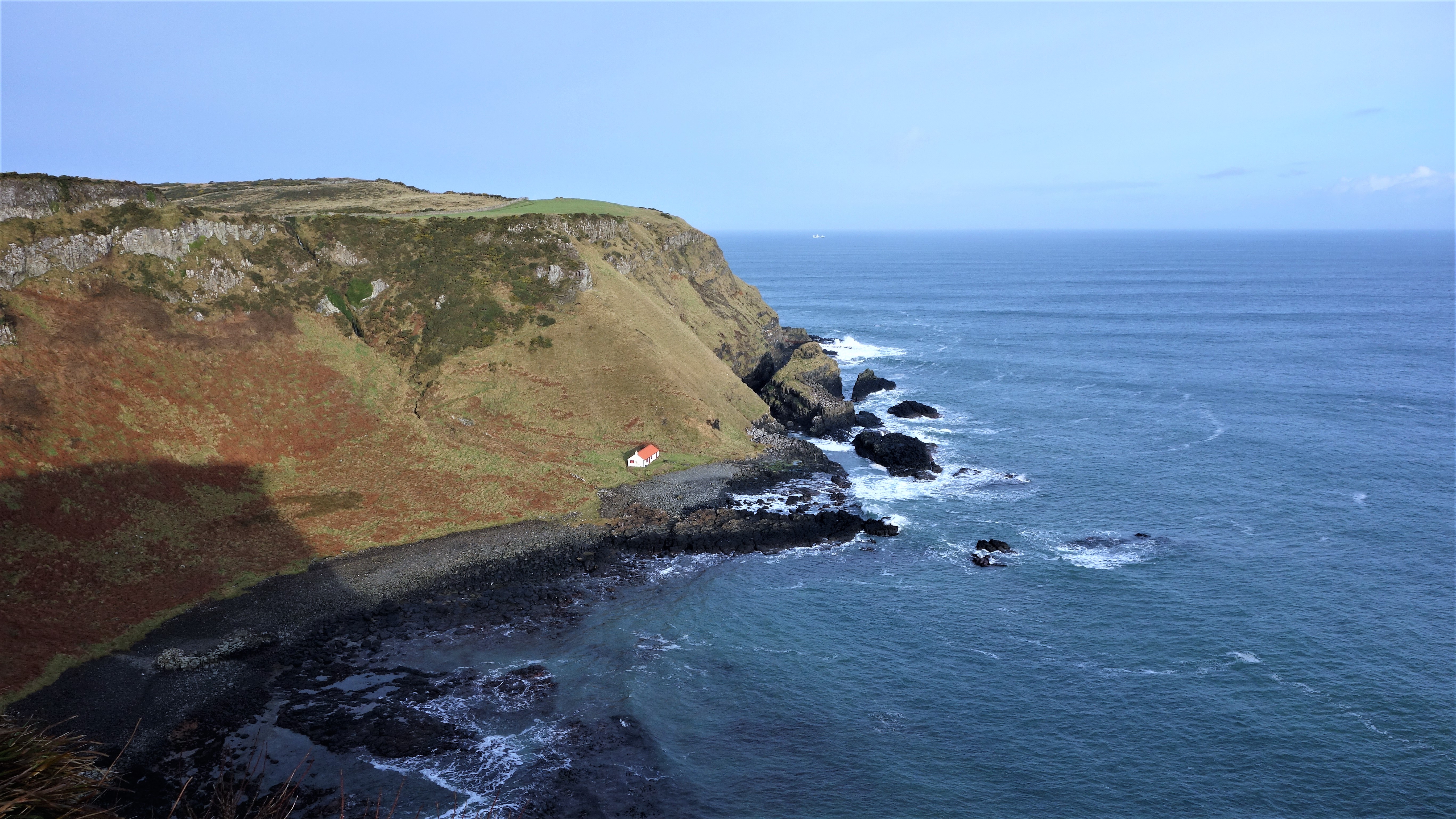
Once at the top, the view was simply stunning…. 🙂 You can see the Portmuck island just behind the bay.

Silent Valley Reservoir County Down

Its maybe hard to believe, but Northern Ireland was once short of water so someone decided to build a big storage place to gather all the rain that keeps falling on our heads for 364 days of the year (it seems) and they called it Silent Valley.

Silent Valley now supplies water for most of County Down and Belfast and it was built between 1923 & 1933 using a workforce of over 1000 men – 8 of whom died in the process. Its situated near Kilkeel and the water supply to fill the dam included diverting a river from Annalong which meant they had to tunnel a 3.62km hole through one of the Mourne mountains (Slieve Binnian) which was an amazing feat lit by using just candlelight.

Today, Silent Valley gets 50,000 visitors a year with most coming to experience the stunning views and make use of the many trails and walks around the area. The park has an information centre, a conference centre, and an education centre, all set inside some old bungalows (see below) and there’s a cafe there too. The famous Mourne Wall also cuts through the park which was constructed to mark out the catchment area for the Silent Valley dam. Its maybe not as good as the one in China but its still pretty impressive when you see it fade off into the distance.

silent-valley-4

After parking your car (its £4.50 entrance fee for a car full of people at time of posting) you walk along the path before arriving at the information centre above. Nothing too impressive yet.

silent-valley-15

Some information on the dam. Apparently the valley used to be called Happy Valley but its not certain why the name was changed (one idea about this is on the sign above). It really is incredibly quiet up there though. Spot the 2 crane flies. 🙂

silent-valley-13

Your first view of the dam. The water was below the overflow level on the day I visited which drains excess water off via the circular construction thing you can see on the right of the picture. I’m not sure where the water goes when it disappears down the hole (maybe its how the devil gets his shower water) but if you want to see it in action there’s a small video here: https://www.youtube.com/watch?v=MxUEfQd4mk4

silent-valley-20 silent-valley-28

The first picture is looking up the reservoir from the walkway embankment. Even on an overcast day like this its still pretty impressive. The second picture is looking across from the left hand side of the water.

silent-valley-71

A little bit of back story about the men who built the dam. They even had their own workers village called “Watertown” and you can still see some of the old foundations of Watertown next to this sign.

silent-valley-46

There are 5 walking routes around Silent Valley with one to suit every ability. I did the “Mountain Trail” (3.4km) route which is considered moderately difficult but it really wasn’t that bad. It gives good views over the reservoir from the left hand side of the water (as you come in). This picture was taken from near the top of the mountain trail.

silent-valley-58

As you descend from the Silent Valley mountain trail you’ll reach the Mourne Wall which usually becomes a feature of many of the Mourne mountain range walks given its meandering 22 miles of length. Its always stunning to see it disappear off into the distance.

silent-valley-6

And finally, a little plaque in memory of the 8 men who died in construction of the dam (and one at Ben Crom dam too).

Portrush County Antrim

I posted (some time ago) a few pictures that I took at the furthest end of the East Strand at Portrush near a place called the White Rocks (named this way because of the colour of the limestone cliffs overlooking the bay) but I haven’t put up any pictures of the actual town area itself. Portrush is undoubtedly Northern Irelands premiere seaside resort with thousands visiting here in the Summer months taking advantage of its two long beaches, amusement rides, and some pretty decent dining too. We visited back in early June this year on a day during the school week, and as you can see the weather was absolutely stunning with very few people there at all – hard to believe, that just a few weeks later, the streets here would be mobbed with families and children. I have to say though, we like it much better when its quiet, particularly in Winter when it takes on a much more melancholy feel yet still retains a wild beauty with the waves crashing onto the shore. Its a great spot for an off season night away and the restaurants here (55 North, The Ramore Restaurant etc) are really excellent and always open.


portrush (1)    portrush (7)

The iconic old railway station clock in Portrush, constructed in mock Tudor style and standing here since the station was completed in the early 1890s. A grandfather clock which stood inside the old station is now on display in Barrys Amusements (the entrance seen in picture 2) which is the largest theme park in Northern Ireland and hits its 90th birthday this year having opened in 1926. Barrys remains a huge draw for all visitors to Portrush and many have fond memories of visiting there as a child (including me) 🙂

portrush (17)  portrush (3)

You might be forgiven for thinking the first picture here is some ocean going liner but it is in fact an area right in the centre of town created for sitting down and having a rest with huge fake masts giving the impression of a ship. If you get the angle just right with your camera the effect is pretty good. The second picture is of Portrushs other iconic landmark, The Arcadia, which is certainly the most photographed location in the town being built in the 1920s. It originally opened as a cafe (which it is today) but became a ballroom for dancing in 1953 and the large complex (now demolished) that once stood behind it played host to many concerts in the 70s and 80s seeing bands like The Stranglers, The Undertones, and Ian Dury play there. I remember the building itself even being a roller disco at one point but I guess I’m showing my age here. I have to say I find the Arcadia enthralling, there’s just something about it. If a building could speak it would have some stories to tell in its 90 years of life, and hopefully it has 90 more.


portrush (6)

There are 2 “strands” in Portrush (another name for its two long beaches at either side of the town) one being the West, and one being the East. The East Strand (seen above) regularly wins a blue flag for its water quality and amenities and its 2.5miles of gorgeous white sand and huge dunes (search “Portrush” on the site here to see pictures of those) really could compete with any of the beaches in Europe. Its a wonderful walk out here on a sunny day looking out to the off shore islands of The Skerries. Its not uncommon to see Basking sharks feeding along here too with their huge fins being visible from the beach (don’t be scared though, they’re harmless).


portrush (12) portrush (9)

The beach at the opposite side of town (the West Strand) which as you can see from the information sign here has enthralled visitors since the Victorian age. This little horse was out for a walk along the promenade the day we were there. Maybe hes a sea horse. 🙂


portrush (15) portrush (16)

Not a cloud in the sky…. A swathe of Portrush guesthouses overlooking the harbour. The second picture here showing the much lauded Portrush lifeboat which has been the saviour of many a poor soul finding themselves in difficulty in the waters around the town. If you look just to the left of the lifeboat you should be able to see the Ramore Restaurant complex which for many years has had a great reputation for good food when in the town – see here: http://www.ramorerestaurant.com/


portrush (18)

Portrush….. A great place to visit. Any time of the year.

Bangor Castle, Bangor, County Down.

Bangor Castle was built for the Hon Robert Edward Ward and his family in 1852. It is presently the headquarters of North Down Borough Council who use the mansions spectacular grand salon as the council chamber. The building is situated in the grounds of Castle Park alongside North Down Museum and is just a short walk from Bangors Walled Garden.

DSC06998

The castle can be hired reasonably cheaply for wedding services and is a popular venue for those seeking a non-religious event.

DSC06985.JPG

Picture taken Christmas 2015 (spot the tree).

DSC06983 DSC06992

DSC06991

Bangor Castle overlooks the town of Bangor and its really worth having a walk around it and Castle Park behind. The walled garden (about ten minutes walk away) has just been used in the brand new film by Ben Wheatley called High Rise.


Helens Bay, Co.Down 10th January 2016

I haven’t posted anything in a while with a few personal things going on, but new year brings new intentions to get things going again, and as ever, the idea is to show just what Northern Ireland has to offer beyond its troubles of the past and its big ship that sunk in the night. There’s much more to our tiny country than those black taxis around tainted murals, or even the wonderful Giants Causeway. Have a look and see what has lay hidden for decades from most travellers eyes, and where most sights are never more than 120mins apart.

All photos were taken with only my Sony compact camera, so my pictures actually are of what you will see (no hyper-realistic SLR pix here as I prefer to show reality). Heres to a great new year of 2016 and I hope it brings each and every one of you much happiness 😀


HELENS BAY – SEAHILL Coastal path, on the evening of January 10th 2016


Helens Bay - Seahill 10.01 (1)

The weather in the north of Ireland (in fact all of the UK and Ireland) has been the wettest ever on record this winter, so we’ve barely seen the sun in weeks. Last night however there was a little glimmer of gold as the day began to fade so we went out for a walk along the shores of Belfast Lough and grabbed a few pics.


Helens Bay - Seahill 10.01 (2)


You cant really see it here, but this is looking across the lough towards Carrickfergus from Helens Bay


Helens Bay - Seahill 10.01 (4)

A rocky beach between Helens Bay and Seahill


Helens Bay - Seahill 10.01 (5)

You might just be able to see a little bench to sit on to the left here, but we decided not to given it was very, very cold!


Helens Bay - Seahill 10.01 (3)

After all that rain, much of the path was muddy and puddled, but it made a nice feature in this picture.


Helens Bay - Seahill 10.01 (6)

Daylight almost gone now, the last embers of light fading into a January night.