Port Moon, County Antrim, Causeway Coast

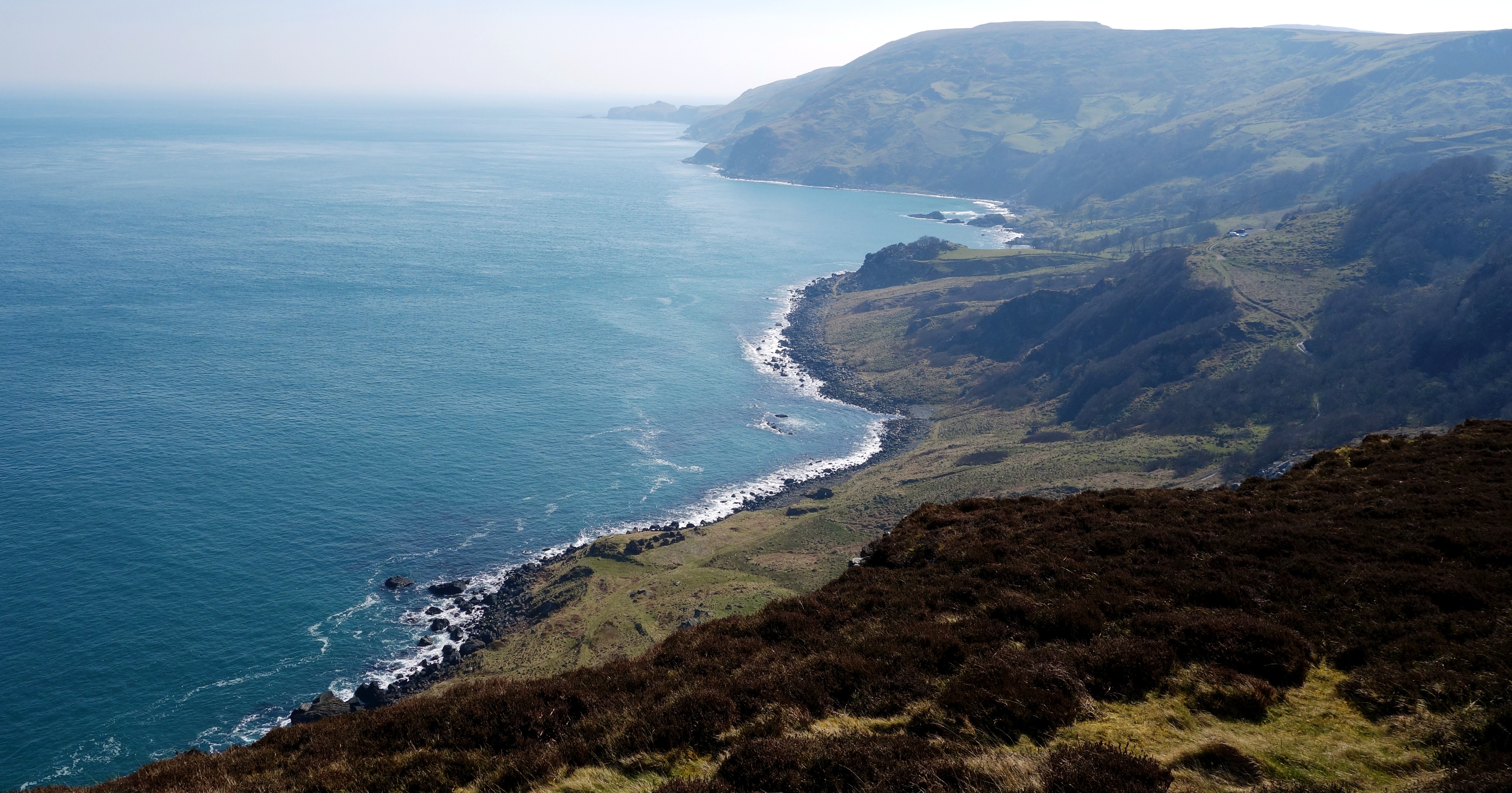
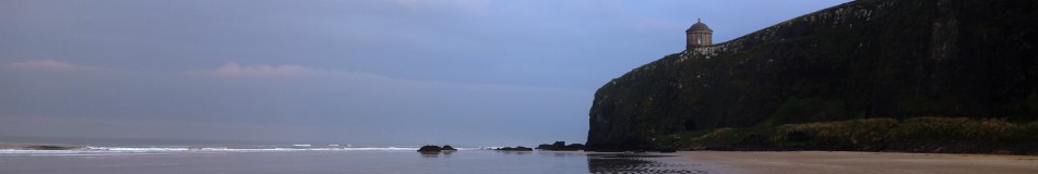
A while ago I posted some pictures taken at Dunseverick Grasslands which involved climbing over the wall at the Dunseverick Castle layby and walking right around the headland there. Its a truly stunning walk and one thats hidden from the road so it can only be accessed on foot. There is another walk in the opposite direction however which is just as amazing towards a magical little bay called Port Moon.

moon-1

Port Moon has a long history of fishing going back well over 200 years and from 1830 nets were attached to the rocks offshore to catch Atlantic salmon on their journey to the river Bush for spawning. Crabs, lobsters and kelp were also harvested here.

moon-2

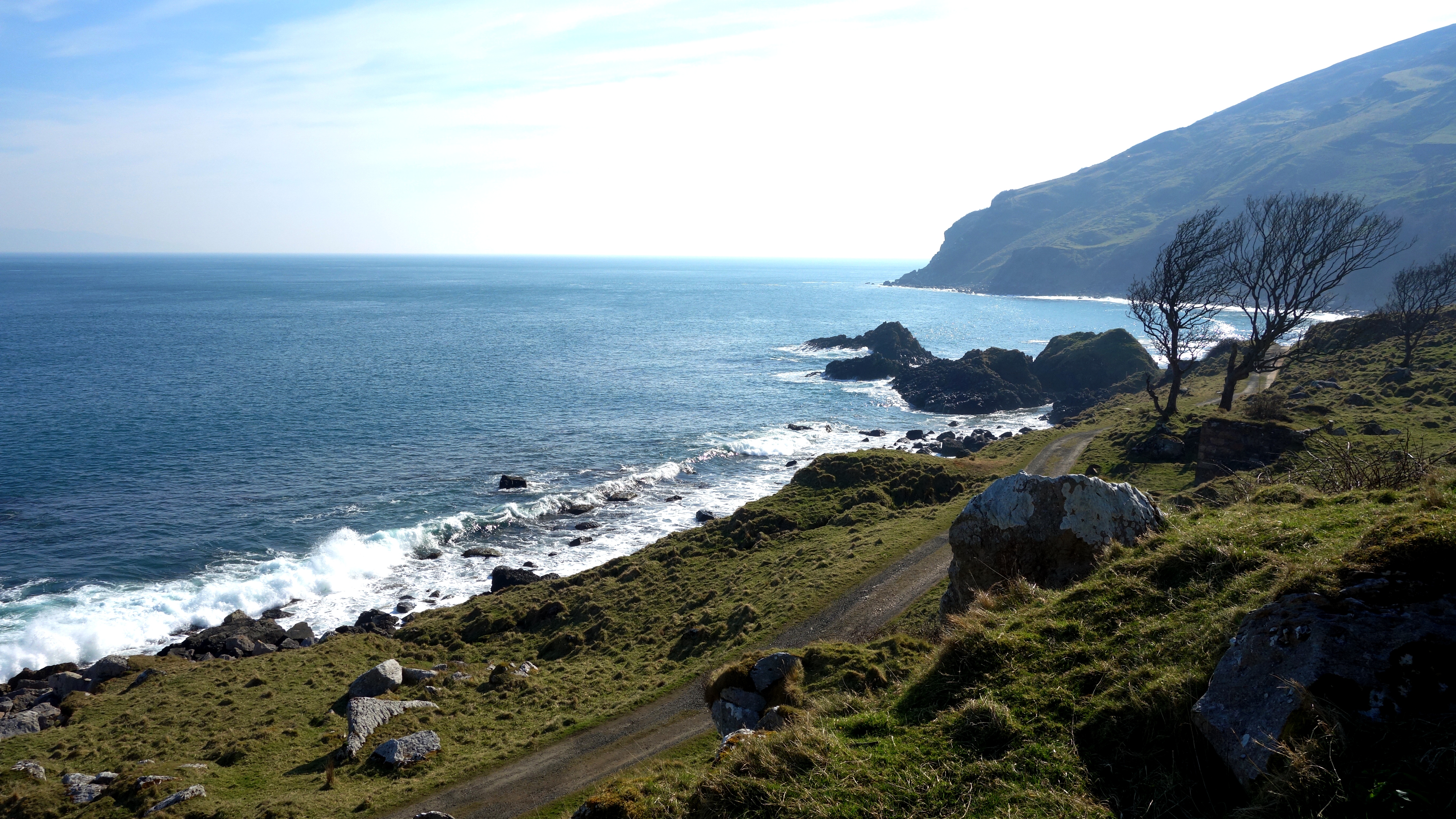
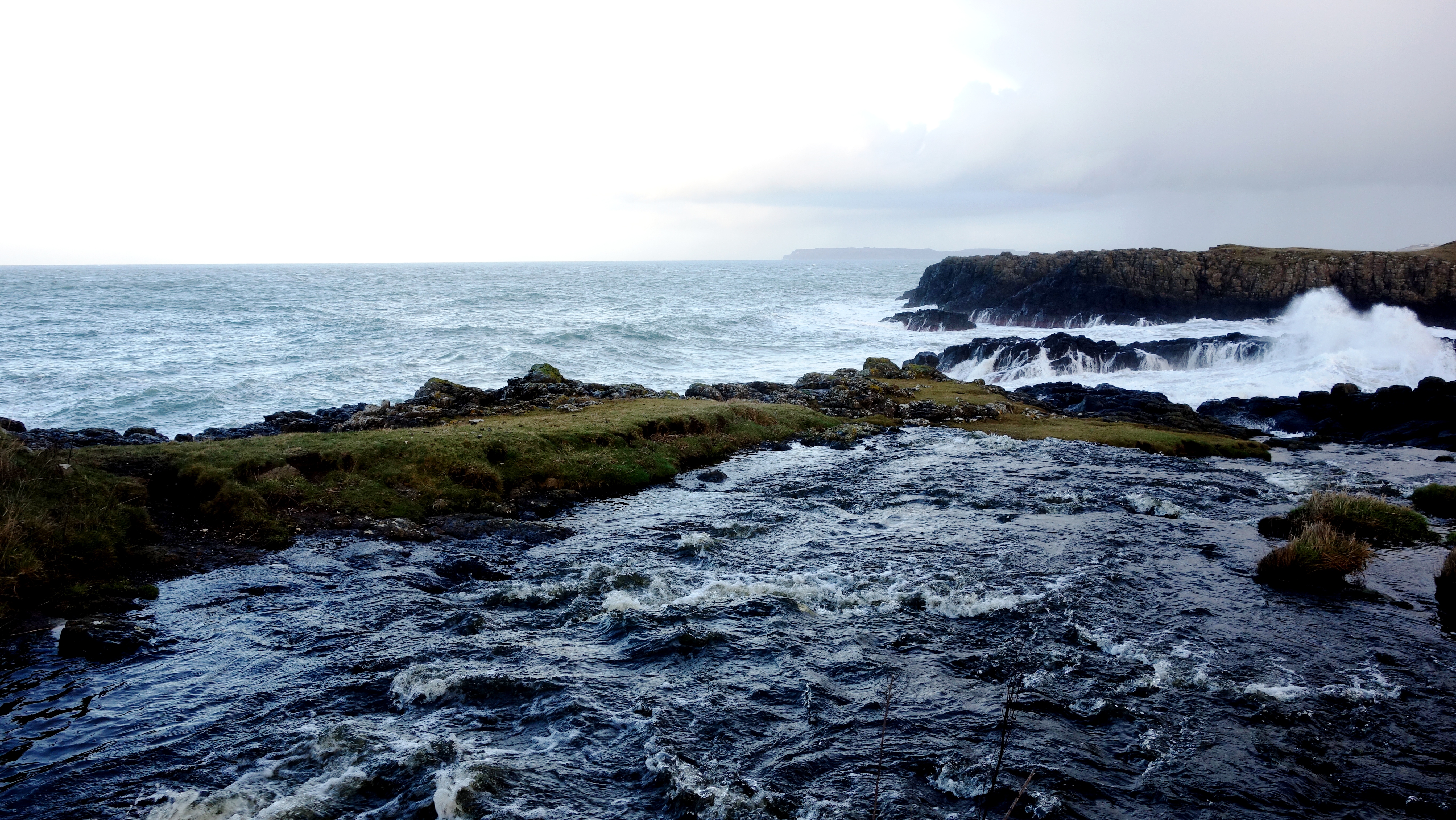
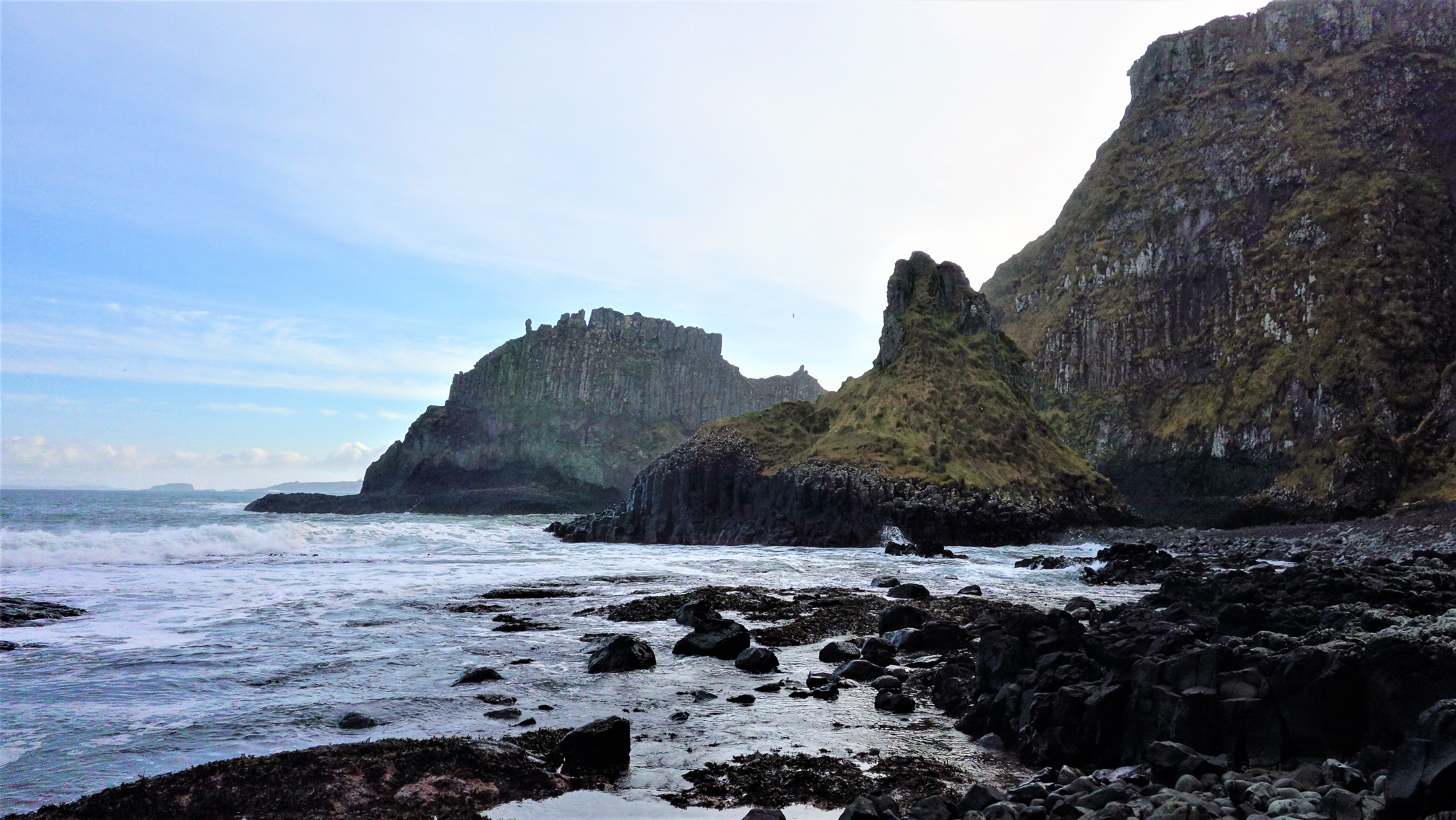
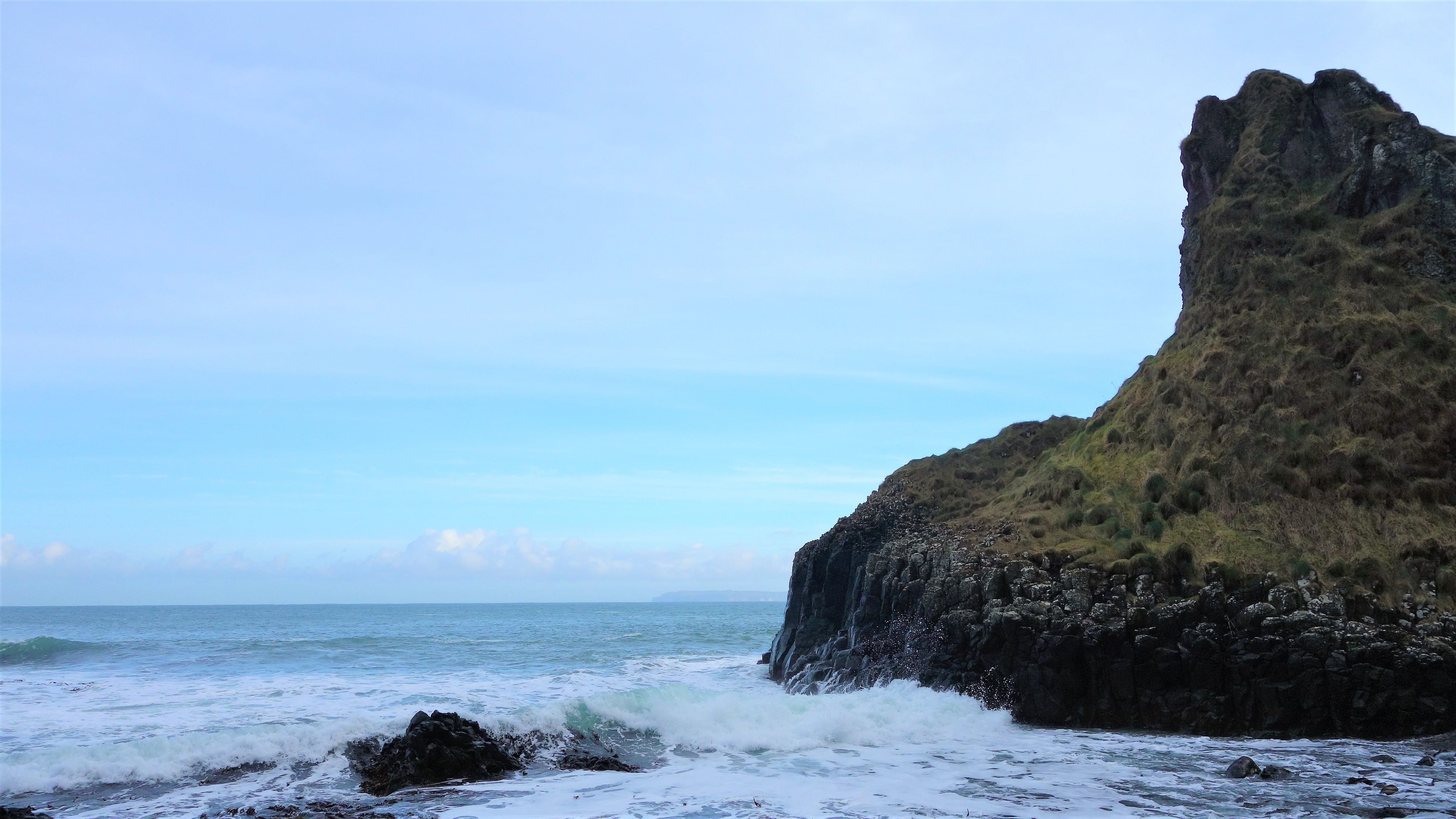
One of the crags jutting out into the sea on the walk to Port Moon, clearly showing the hexagonal columns which cover this area very close to the Giants Causeway (less than 5mls away).

moon-3 moon-4

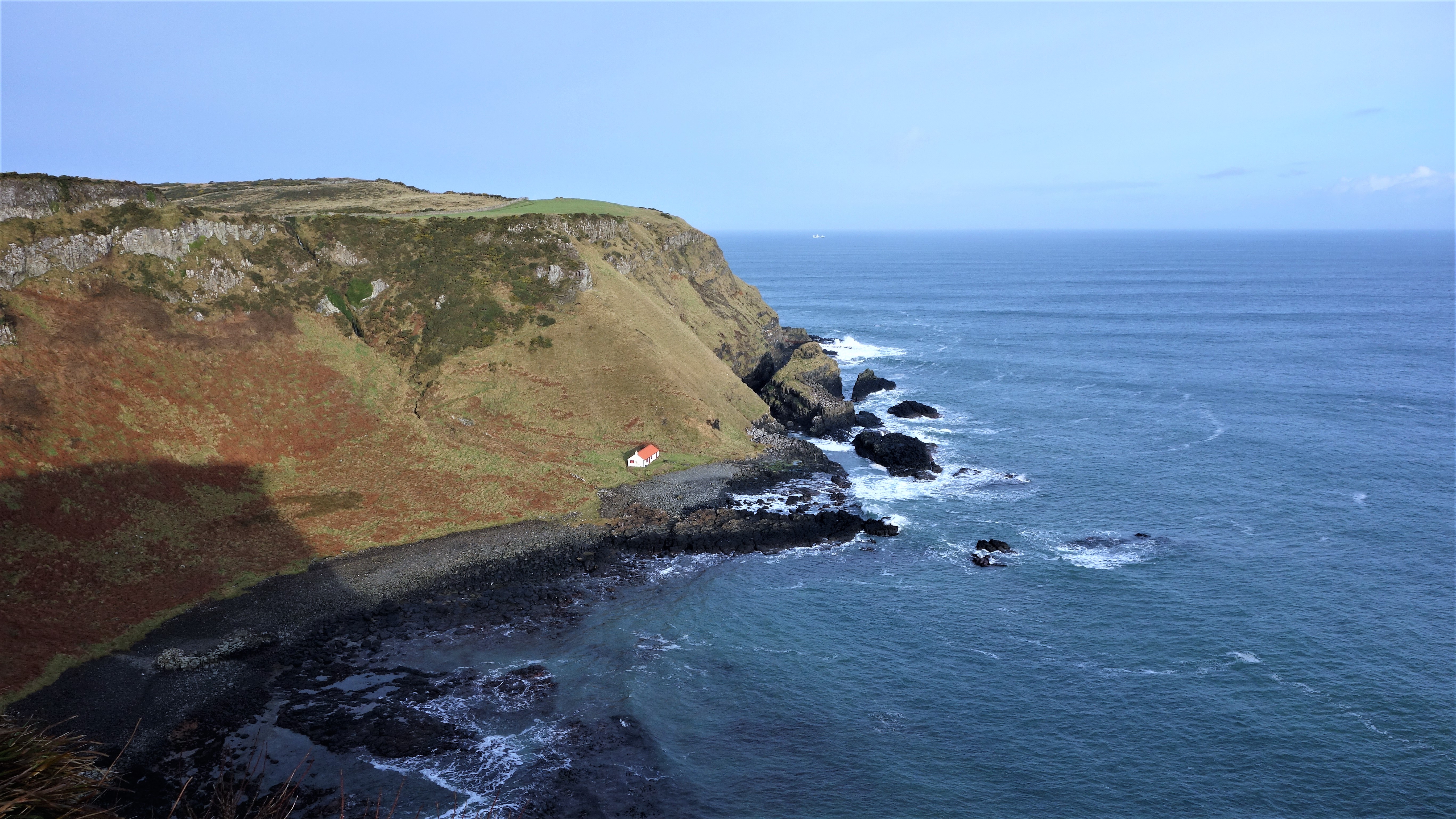
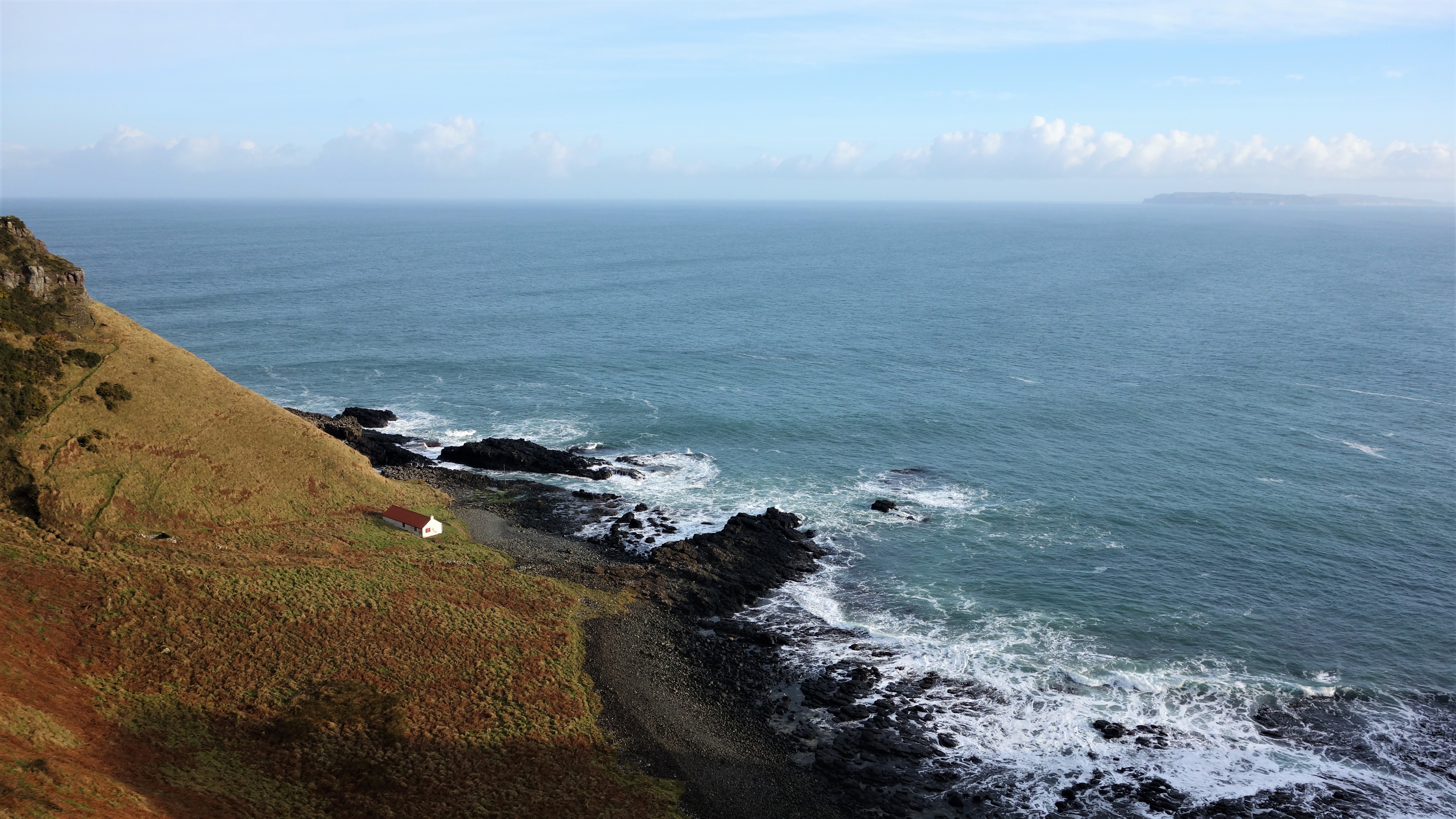
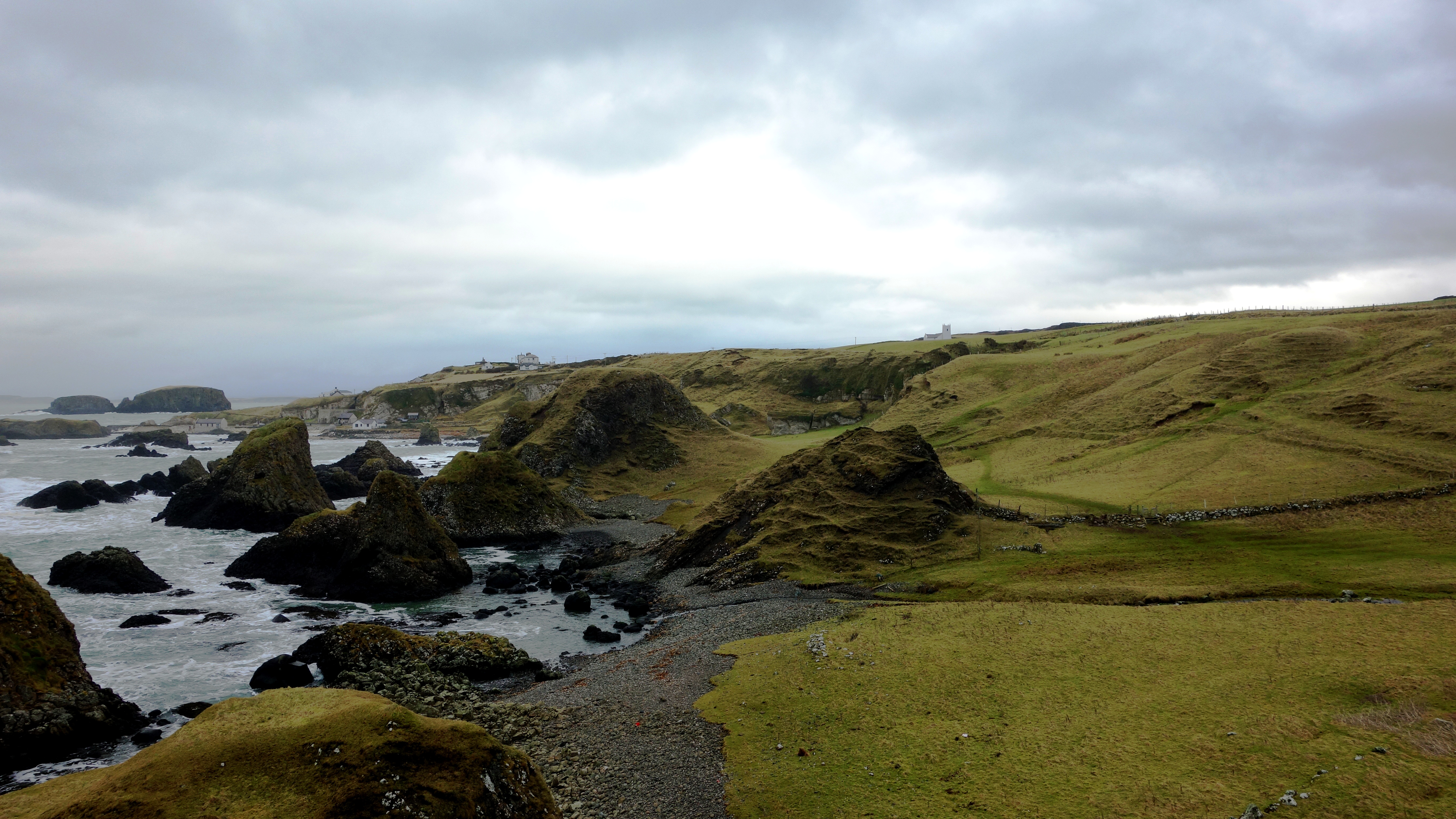
Your first views of the little “Fish House” bothy seen from several hundred feet above Port Moon bay (and yes, you can climb down there if youre brave enough).

moon-6 moon-5

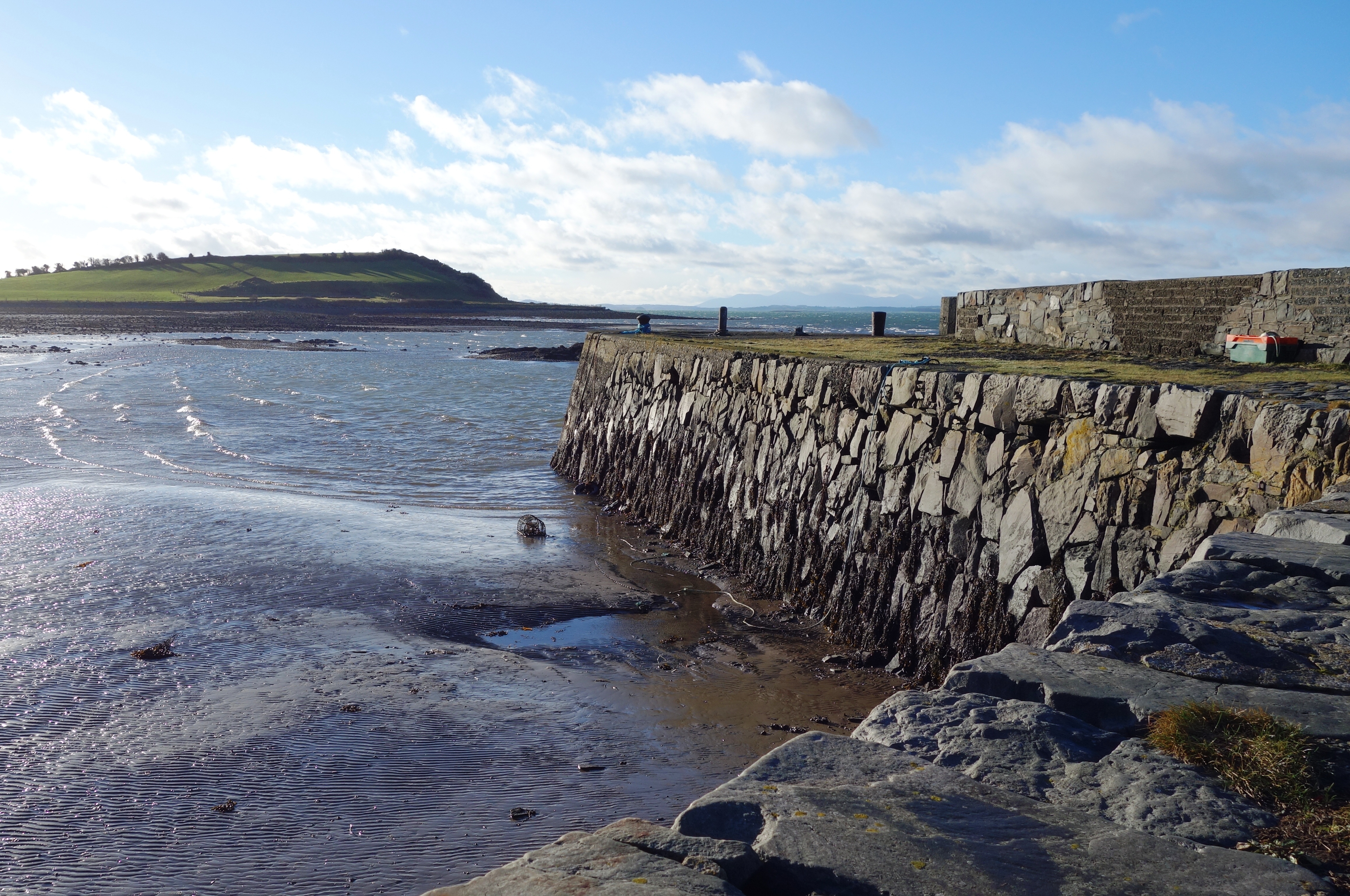
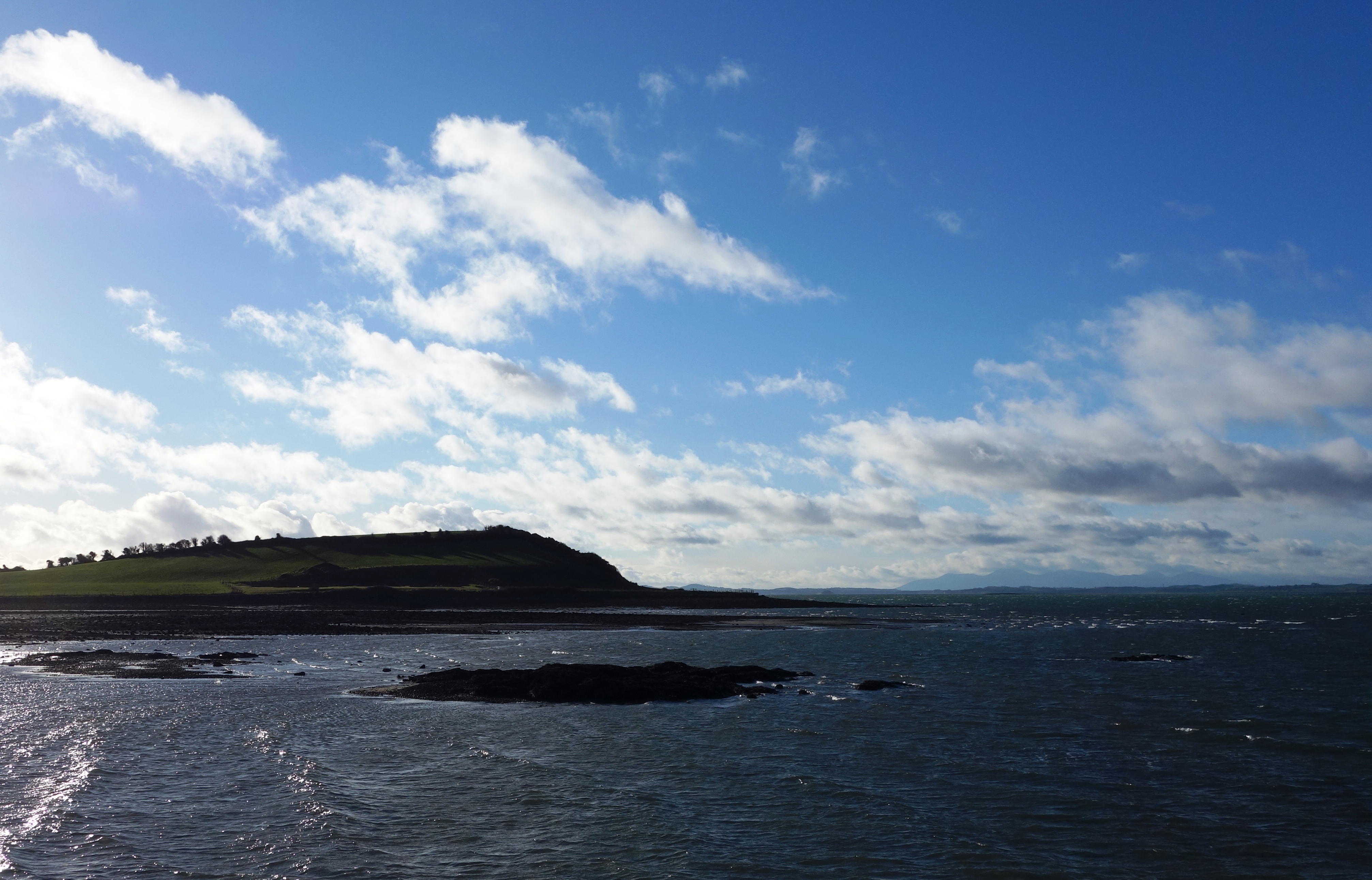
The surrounding area is simply stunning.

moon-7

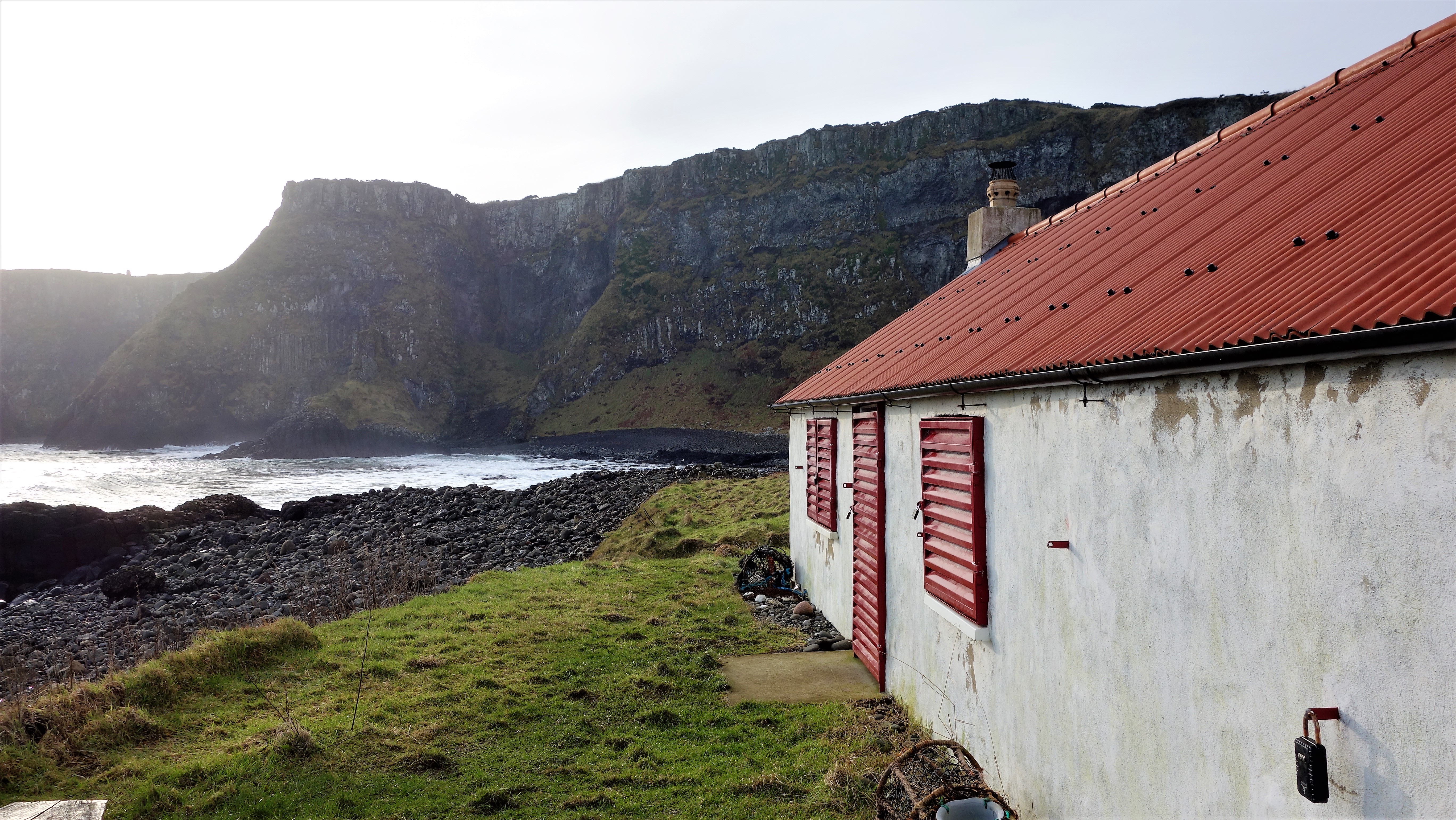
After climbing down the looping path to the bottom of the cliff (it looks much more scary than it actually is, but be careful if its been raining as it can be slippery) you arrive at the old Fish house which now operates as a bothy (a small hut or cottage used as a refuge) which you can arrange to stay at if youre feeling adventurous (see here: http://www.canoeni.com/canoe-trails/north-coast-sea-kayak-trail/access-point/port-moon/ ). The building used to house all fishing operations at Port Moon but had fallen into disrepair until it was resurrected as a bothy in 2011. There are some pictures of the inside here https://www.hikersblog.co.uk/an-overnight-stay-in-port-moon-bothy/ but normally its locked.

moon-9 moon-8

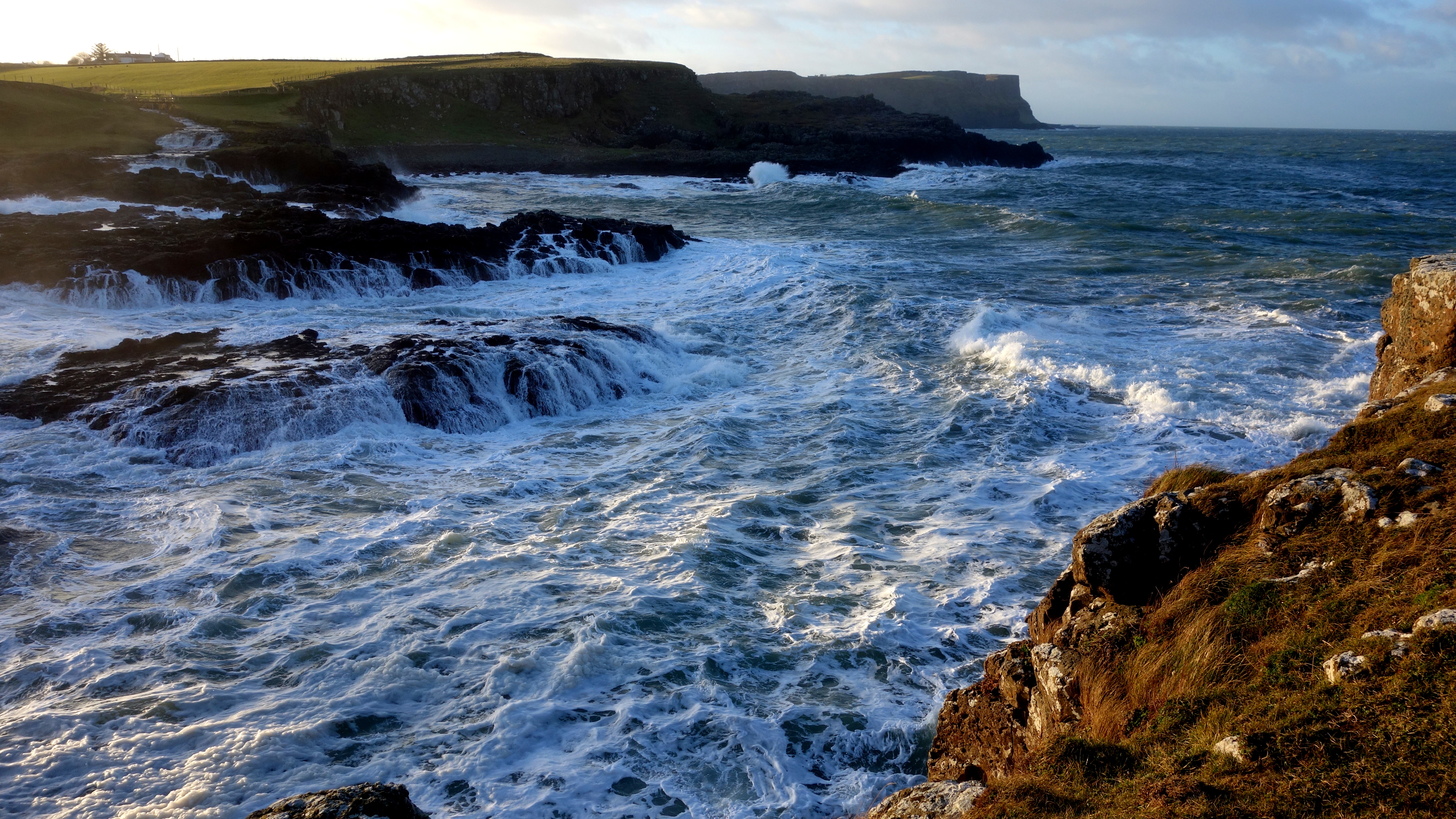
Looking out across the bay from the Port Moon shore. Not bad for a wintery February morning!

moon-10

The bothy seen from the opposite side of the crescent shaped (moon shaped) bay.

moon-11 moon-12

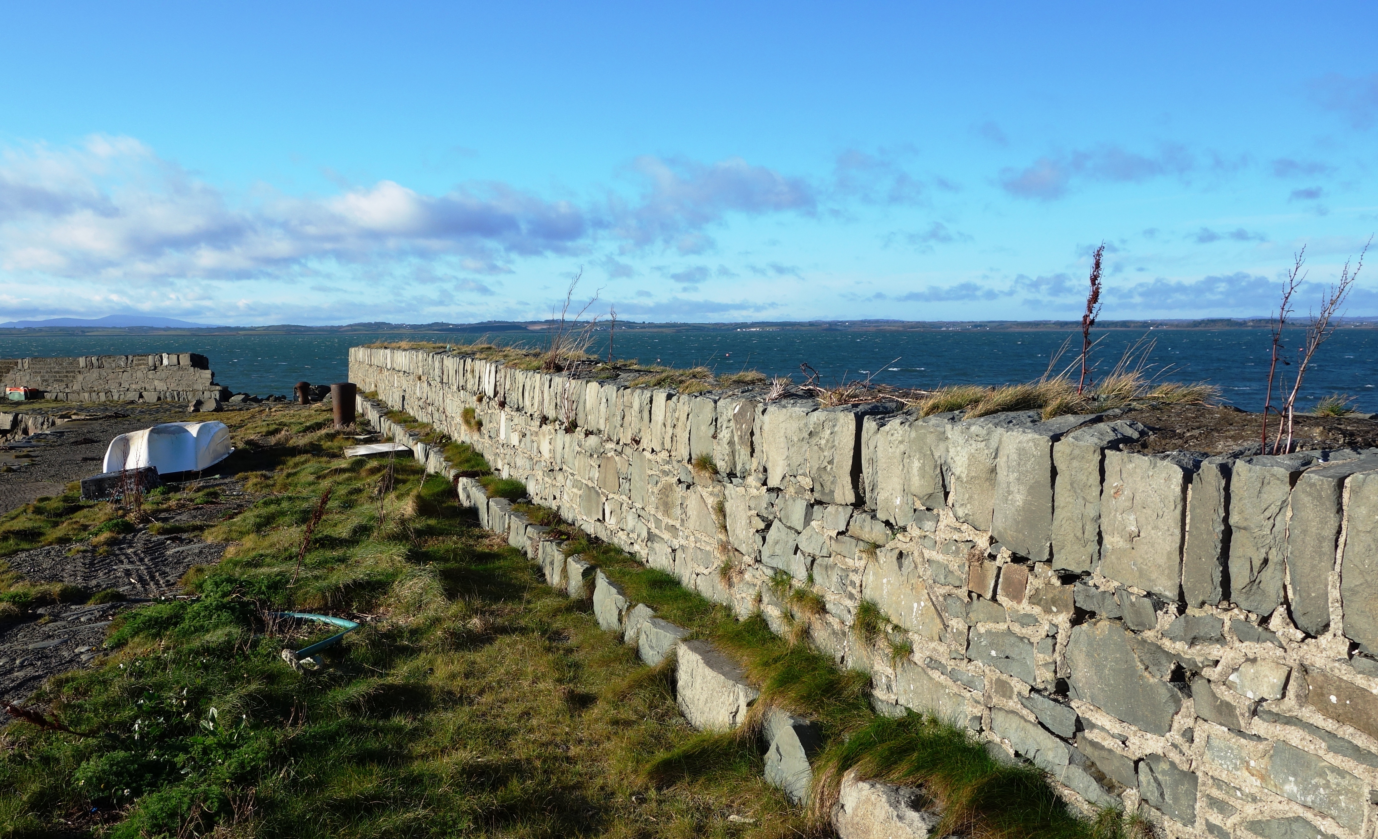
Port Moon, a magical little place now deserted and haunted by the ghosts of its fishing past. Its really worth seeing and its very much an undiscovered gem of NI that most residents wont even have seen. Dunseverick Castle may not be much to look at but once over that wall and walking either left or right youll surely be impressed.


Whitepark Bay, County Antrim, Panorama View

Ive been a little busy this past month or so as our landlord decided to sell the house we’ve been renting (privately for 5 years) so we had to find another home (arrgh!) Its been a bit of a stressful time house-hunting but we finally found somewhere new and now its just a matter of getting everything packed up to move on. I really wanted to get a few pictures on the site for the month of April however as its almost over and I didn’t want to miss this months entry, so the two pictures below are just a quick post to fill the gap. 🙂

The two photographs below were taken (as always with my trusty compact camera) from the roadside overlooking the beautiful Whitepark Bay in County Antrim. Ive already posted some pictures of Whitepark before (see here:  https://niviews.com/2015/02/18/whitepark-bay-north-coast-county-antrim/ ) but not from such a high vantage point as seen here. The pictures were taken back in June 2015 on a glorious summers day, and basically the first one is looking left from our stopping point on the road and the other is looking right. A truly stunning vista….

whitepark (6)

Looking left over Whitepark Bay, you can see the tiny village of Portbradden sitting just beyond the cliffs, and Fairhead is far off in the distance.


whitepark (5)

Looking right, down to the south end of the bay where you can hunt for one of the many prehistoric fossils strewn along the shore. Whitepark is a beautiful (and almost always tranquil) spot on the renowned County Antrim coast.


See you next month….. 🙂

Fair Head aka Benmore, County Antrim

Fair Head is a rocky headland about 3 miles East of Ballycastle and is the closest part of Northern Ireland to Rathlin Island. It is a popular rock climbing area and it is believed to have the largest climbable area of rock in the British Isles. If its your first visit (it was ours) it can be pretty hard to find. Its very easy to see Fair Head (either from Ballycastle town or Murlough Bay – posted earlier) but after following the road signs you’ll come to a small group of old cottages that look like a farmyard and it will seem like you can go no further. Theres a car park to your right as you drive past the cottages, which isnt even marked as a public car park until you actually drive into it, and there is no mention of this being the start of the Fair Head walk (again, until you drive into the unmarked car park using your guesswork). Someone really needs to sort the area out as it looks as if its just been left abandoned, and given its reasonable to assume tourists might want to come here, then could we maybe invest in some further signs? That would be helpful. Thanks Mr Antrim Coast & Glens man 🙂

fair head (1) fair head (2)

So when you find the car park among the (seemingly empty) white cottages, drive in and park up and youll see this sign hilariously hidden behind a wall lol. The sign says there are “yellow circles” marking the route to Fair Head but good luck with that as we found only one which had been bleached white. Maybe they repaint them now and again but we just wandered about like lost sheep (across marshy bog land) and only found the edge of the cliff by trial and error.

fair head (4)

The area up to Fair Head was pretty expansive. The car park from this point is further away than that lake you see in the distance.

fair head (3)

Our first view from the edge. It was hard to keep the horizon straight for the pictures as we couldn’t see it, it was quite a hazy morning. The second bay in the distance is Murlough Bay where the big white house is I posted earlier. The sign says you can walk from here and it takes 90mins, but I really imagine its much more.

fair head (5) fair head (7)

Its always hard to convey exactly how high up a place is in photographs, no picture can really do it justice. The highest point here is 196mtrs above the sea, and quite a bit of it is near vertical. If you have a fear of heights beware! In the distance (in the first picture) you can see Rathlin Island.

fair head (10)    fair head (8)

We saw this climber about to descend the huge wall of rock at Fair Head. This picture will give you some idea of the size of the rock face. In the second picture is a little dog who followed us up from just after the car park. She seemed to be alone as no one else was around, and the climber we came upon didn’t know who she belonged to either. When we were leaving she simply disappeared again. Maybe it was some doggy spirit of the Fair Head moors haha woof!

fair head (12)     fair head (13)

We made our way back to our car (across wet and squelchy fields) and on passing the lake took this photo of the island on it. The lake is called Lough na Cranagh and the island, known as a “crannog” was man made in the Iron Age by extending a small natural island and surrounding it with a stone wall. It was likely a place of refuge. The entire area of Fair Head is now owned by the National Trust in NI. Hopefully they can invest in some nice signs soon up there then. 🙂

Murlough Bay, County Antrim April 2015

Its not often, though its happened for a few years now, where we actually get great weather in April in NI. And given this was Easter week, all the schools were closed and many people had taken to their cars to head to the seaside. With that in mind, we set out pretty early from home and arrived at Murlough Bay around 9am. At this point I need to say that there are essentially two “Murlough Bay” in Northern Ireland, one in Co.Down and this one in Co.Antrim. Make sure you locate the correct one haha. The bay in Country Antrim is likely a little harder to find but in many ways that makes it all the more peaceful when you finally get there. There are 3 car parks at the site and my view is to totally ignore the first one (you come to) unless you want to stop there first and take a photo of the view below before you descend (the first picture here shows that view). Move on then to at least the second car park along the (pretty narrow) road and park up, or take the route of the brave, past the subsidence warning sign, to the last car park no.3 – which is the most perfect stop but many may not want to risk it. From here you will have no climbing to do back to your car however. Murlough Bay sits between Fair Head (posting that next) and Torr Head, near Ballycastle.

mb (1)

This is the view if you stop and walk a little down hill from the first car park. If you look towards the centre of the picture you should be able to see a white van, that is in no.2 car park. From there you can see the (tiny) road cutting diagonally away heading for the last car park. Be advised that all 3 are quite small so you should arrive early or you might have some reversing to do. You can see a small part of Rathlin Island in the distance to the left of the picture.

mb (3) mb (4)

Theres a road that extends beyond the third car park but dont drive any further. It leads to a private cottage so just walk along here instead. On your way you will pass an old lime kiln still in good condition. They put alternate layers of limestone (from the hills above) and coal in it to burn and produce quicklime used in cement etc (the quicklime was raked out of the arch at the bottom after burning).

mb (5) mb (6)

Look up here, about 200ft high above you are the limestone cliffs used in the kiln, hard to believe these were once under the sea. The little cottage is called a “Bothy” an old labourers cottage used either for kiln workers or fishermen I suspect. Sometimes these would be left open as a refuge, but this one is locked.

mb (7)  mb (9)

Over to your left are the remnants of some long lost building foundations, and part of a wall. Maybe a fishery or some ancient cottage. After that you will come to this private house. I reckon it must get a lot of photographs taken of it, as it adds a great focal point to the entire area. The bay and Torr Head lie before you.

mb (15) mb (11)

A place of natural beauty. Fair Head pointing towards the sky in the first picture. Torr Head in the second. You might just be able to see the shadow of Scotland on the horizon here.

mb (23)  mb (24)  mb (29)

Like a land that time forgot. Murlough Bay, County Antrim,  10th April 2015 🙂

Ballintoy, County Antrim. Game of Thrones, Pyke Harbour

So not long now until the premiere of Season 5 of Game of Thrones (12th April 2015) so I thought Id mark that with a little mention of Ballintoy which substituted as Pyke Harbour in Season 2 of the series. A permanent plaque stands there now for visiting fans to read and it looks as if Northern Ireland will be home to the show for a while longer as Season 6 will also be filmed here. Ballintoy is a quiet little village with an attractive small harbour, but walk left around the headland and it has some amazing scenery. There are also some caves you can enter (though you may need wellingtons). 

balintoy (2)

Some information.

balintoy (13) balintoy (14)

Do you remember this place? Its probably pretty recognizable as Pyke harbour even without the special effects.

balintoy (12) balintoy (15)

On the left is Roarks Kitchen, which is a little cottage style cafe that’s been serving lovely food here for 35yrs. And on the right is another view of the harbour used in Game of Thrones.

balintoy (1)

Now follow the path left, walking away from the harbour and past this little house (there’s a cave before you get there you could maybe walk into, though it might have some shallow water in it).

balintoy (5)

The view ahead.

balintoy (4)

You can climb up some of the huge grass covered rocks (be careful) which have trails left by local sheep. Once at the top of this one, the view back to the harbour is quite amazing (you should be able to see it in the distance here).

balintoy (9) balintoy (10)

A huge eroded arch just off the shore, and a bit further out…….. arrrgh….. a shark!! 🙂

balintoy (7)ballintoy church (1)

Its easy to see here how vast the immediate landscape is, with all its greenery, yet having a look like some strange alien planet. And in this first picture you might just be able to see a little church on top of the hill. This is Ballintoy church, built in 1813 and seen closer in the second picture. Ballintoy is definitely worth stopping off at if you’re visiting the north coast, even if you’re not a fan of Game of Thrones 🙂

Dunseverick Grasslands, Causeway Coast, County Antrim

Having already posted Dunseverick Castle a little while ago, Im going to post a few pictures of what lies beyond there and Dunseverick Harbour. And I have to say, I can barely put into words how outstanding this part of the Causeway Coast Walk is, it really is mind blowing. And on a day like the one we had there, I doubt you’ll find anywhere on the entire island of Ireland that looks so awesome for its pure natural beauty.

As ever, all pictures are pretty high definition so they might take a little while to open on a mobile phone (you might have to wait for them to focus). All were still taken with nothing but a compact camera however. Something I always intend to do on this site as an encouragement to those believing you need a huge camera to take a decent picture . Not true. 😀

dunseverick grasslands (1)

Less than 3.5mls from the Giants Causeway, lies the ruins of Dunseverick Castle. Ive already given details of it (and some pictures) on an earlier post, so I wont go into it again. But once you arrive at the small roadside car park (overlooking the remnants of the building), climb the right hand side wooden stile over the wall there, and continue going right around the headland. This is the beginning of whats known as the Dunseverick grasslands, and I guess the picture above speaks for itself.

dunseverick grasslands (2)

Looking ahead as we walked on towards Dunseverick harbour from the castle.

dunseverick grasslands (3)

The expanse of gorgeous rugged coastline before you really is dumbfounding.

dunseverick grasslands (4)

It doesn’t get any more dramatic than this in Northern Ireland.

dunseverick grasslands (5)

It kinda felt like the opening scenes from the movie Prometheus at this point, so primordial, so raw and pure, a world free from anything at all but water and plant life.

dunseverick grasslands (7)

Those ridges are the scars of some long past human habitation.

dunseverick grasslands (8)

I wish I could convey the sound and the vibrations we felt watching this sight. A whirling pool of awesome ocean power, like the planets largest washing machine churning its way through rocks and sand. The waves sounded like huge bass bin explosions going off, and if you ever wondered just how a bit of swirling water could cause the kind of erosion you were told about in school geography lessons, a few minutes standing here would easy confirm it all. Amazing!!

Kircubbin, County Down

Sitting on the shores of Strangford Lough, Kircubbin is a small town with a harbour sitting between Newtownards and Portaferry.

kircubbin (6)

Kircubbin, County Down.

kircubbin (1)

The old harbour at Kircubbin with a lost lobster creel. The harbour looks like its seen better days.

kircubbin (3)

On the edge of the harbour there’s this stone, I cant find anything on Google as to whether its true or not, but I doubt someone would go to the trouble of making it if not.

kircubbin (7)

The view out to sea from the harbour.

kircubbin (11) kircubbin (12)

kircubbin (8)

An old antique shop on the main street. now an antique itself.