A 2017 Winters Morning. Portrush, White Rocks Co.Antrim

Even in Winter, on the windswept North Antrim coast (which gets a never ending battering from the Atlantic ocean), you can find peace and solitude away from the tourist draws of Belfast. No murals here, no big buildings with sunken ships, no relics of mans past, just a natural sight that hasnt changed for millenia.  


Shortly after sunrise on a cold, but beautiful February morning in 2017. White Rocks, near Portrush.


Stretching far off into the distance you would be looking towards the Giants Causeway and Fair Head here.


Slightly further up the coast from the White Rocks theres a small car park that has a stunning view. In one direction you can look back towards the rocks (and Portrush can be clearly seen) and in the other…. Dunluce Castle sits perched on its cliff top where its seen thousands of sunrises just like this one (click for large pictures).


A final view from above the White Rocks where the second biggest sand dune in Ireland towers above the beach as early walkers come out to take advantage of the sunshine.

Whitepark Bay, County Antrim, Panorama View

Ive been a little busy this past month or so as our landlord decided to sell the house we’ve been renting (privately for 5 years) so we had to find another home (arrgh!) Its been a bit of a stressful time house-hunting but we finally found somewhere new and now its just a matter of getting everything packed up to move on. I really wanted to get a few pictures on the site for the month of April however as its almost over and I didn’t want to miss this months entry, so the two pictures below are just a quick post to fill the gap. 🙂

The two photographs below were taken (as always with my trusty compact camera) from the roadside overlooking the beautiful Whitepark Bay in County Antrim. Ive already posted some pictures of Whitepark before (see here:  https://niviews.com/2015/02/18/whitepark-bay-north-coast-county-antrim/ ) but not from such a high vantage point as seen here. The pictures were taken back in June 2015 on a glorious summers day, and basically the first one is looking left from our stopping point on the road and the other is looking right. A truly stunning vista….

whitepark (6)

Looking left over Whitepark Bay, you can see the tiny village of Portbradden sitting just beyond the cliffs, and Fairhead is far off in the distance.


whitepark (5)

Looking right, down to the south end of the bay where you can hunt for one of the many prehistoric fossils strewn along the shore. Whitepark is a beautiful (and almost always tranquil) spot on the renowned County Antrim coast.


See you next month….. 🙂

Kinbane Castle, Ballycastle, County Antrim

Kinbane Castle isnt really a place many seem to know about here, even though it lies between Ballintoy and Ballycastle and is quite well signposted from the main road. We had never stopped here before ourselves and we really didn’t expect much as we pulled into the car park but all I can say is… wow!….. once you discover what this place looks like I reckon you’ll be back. The area is stunning and we were kinda ashamed that some American and German tourists were already here (when we arrived) given we had never even seen the place. Not too much is known about Kinbane, but it didnt last very long after being constructed it seems. The castle was built by Colla of the MacDonnell clan, the clan who also built many other castles and buildings in the area including Dunluce and Dunseverick. The English laid siege to it within a few years of its completion in 1551 as they were getting a bit concerned about the strength of the ruling MacDonnell Clan (and their friendly connections with Scotland just across the water), but the castle prevailed at this point. Another attack took place in 1555 however where the castle was partly destroyed by cannon fire but it was rebuilt afterwards.  The hollow below the castle is known as Lag na Sassenach (Hollow of the English) and it was allegedly during the 16th century that a garrison of English soldiers laying siege to the castle were surrounded and massacred. Fires lit on the headland as calls for assistance were answered by clansmen who came from all directions and surrounded the garrison rolling rocks onto the English below crushing their advances. Game of Thrones for real eh?

kinbane (5) kinbane (12)

Hopefully you can read the information on the 1st picture here (click for large high def) and this second photo is your 1st glimpse of the castle.

kinbane (1) kinbane (26) kinbane (27)

When you arrive at the castle car park you’re pretty high up, and the surrounding area and views are just amazing. Just look at those cliffs (and the beautiful June weather). Thats Fair Head in the distance btw.

kinbane (28) kinbane (36) kinbane (32)

The view of the castle taken from about halfway down the descent to sea level, and when you reach the bottom you’ll come to another sign with more information and a further sign warning of your possible doom haha (erm, and I wouldn’t take it lightly either, if you’re going out to the end of the headland be very careful!)

kinbane (58) kinbane (63) kinbane (34) kinbane (37)

A stunning location for a castle though it was placed here (of course) for strategic reasons. The second picture was taken from inside the tower looking out, and the third picture is of one of the remaining “gun loops” – ie. where they placed the huge cannons (you can see some of the steps down to the castle in the last picture).

kinbane (16) kinbane (23)

Just below the castle are the ruins of what looks like some old fishery, Im not sure of the history of this, but I expect its a few hundred years old rather than several (like the castle). It provides a nice backdrop to the area however.

kinbane (45) kinbane (56) kinbane (69)

The first two of these pictures were taken from the cliff top behind the castle and in the first one (if you look closely towards the right) you might be able to see some people standing beside the old fishery shown in the pictures above. This will give you a sense of the scale of the place and the heights involved. The people in the second picture are sitting right at the very tip/end of the precipice shown on the third pic. Honestly, this is only for the brave and likely very dangerous in Winter!

kinbane (67)

Kinbane Castle, still projecting its dominance 500yrs later. You really should visit here.

Fair Head aka Benmore, County Antrim

Fair Head is a rocky headland about 3 miles East of Ballycastle and is the closest part of Northern Ireland to Rathlin Island. It is a popular rock climbing area and it is believed to have the largest climbable area of rock in the British Isles. If its your first visit (it was ours) it can be pretty hard to find. Its very easy to see Fair Head (either from Ballycastle town or Murlough Bay – posted earlier) but after following the road signs you’ll come to a small group of old cottages that look like a farmyard and it will seem like you can go no further. Theres a car park to your right as you drive past the cottages, which isnt even marked as a public car park until you actually drive into it, and there is no mention of this being the start of the Fair Head walk (again, until you drive into the unmarked car park using your guesswork). Someone really needs to sort the area out as it looks as if its just been left abandoned, and given its reasonable to assume tourists might want to come here, then could we maybe invest in some further signs? That would be helpful. Thanks Mr Antrim Coast & Glens man 🙂

fair head (1) fair head (2)

So when you find the car park among the (seemingly empty) white cottages, drive in and park up and youll see this sign hilariously hidden behind a wall lol. The sign says there are “yellow circles” marking the route to Fair Head but good luck with that as we found only one which had been bleached white. Maybe they repaint them now and again but we just wandered about like lost sheep (across marshy bog land) and only found the edge of the cliff by trial and error.

fair head (4)

The area up to Fair Head was pretty expansive. The car park from this point is further away than that lake you see in the distance.

fair head (3)

Our first view from the edge. It was hard to keep the horizon straight for the pictures as we couldn’t see it, it was quite a hazy morning. The second bay in the distance is Murlough Bay where the big white house is I posted earlier. The sign says you can walk from here and it takes 90mins, but I really imagine its much more.

fair head (5) fair head (7)

Its always hard to convey exactly how high up a place is in photographs, no picture can really do it justice. The highest point here is 196mtrs above the sea, and quite a bit of it is near vertical. If you have a fear of heights beware! In the distance (in the first picture) you can see Rathlin Island.

fair head (10)    fair head (8)

We saw this climber about to descend the huge wall of rock at Fair Head. This picture will give you some idea of the size of the rock face. In the second picture is a little dog who followed us up from just after the car park. She seemed to be alone as no one else was around, and the climber we came upon didn’t know who she belonged to either. When we were leaving she simply disappeared again. Maybe it was some doggy spirit of the Fair Head moors haha woof!

fair head (12)     fair head (13)

We made our way back to our car (across wet and squelchy fields) and on passing the lake took this photo of the island on it. The lake is called Lough na Cranagh and the island, known as a “crannog” was man made in the Iron Age by extending a small natural island and surrounding it with a stone wall. It was likely a place of refuge. The entire area of Fair Head is now owned by the National Trust in NI. Hopefully they can invest in some nice signs soon up there then. 🙂

Murlough Bay, County Antrim April 2015

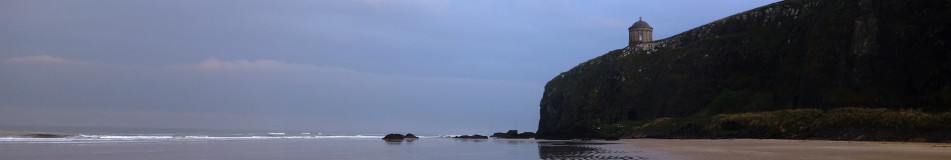
Its not often, though its happened for a few years now, where we actually get great weather in April in NI. And given this was Easter week, all the schools were closed and many people had taken to their cars to head to the seaside. With that in mind, we set out pretty early from home and arrived at Murlough Bay around 9am. At this point I need to say that there are essentially two “Murlough Bay” in Northern Ireland, one in Co.Down and this one in Co.Antrim. Make sure you locate the correct one haha. The bay in Country Antrim is likely a little harder to find but in many ways that makes it all the more peaceful when you finally get there. There are 3 car parks at the site and my view is to totally ignore the first one (you come to) unless you want to stop there first and take a photo of the view below before you descend (the first picture here shows that view). Move on then to at least the second car park along the (pretty narrow) road and park up, or take the route of the brave, past the subsidence warning sign, to the last car park no.3 – which is the most perfect stop but many may not want to risk it. From here you will have no climbing to do back to your car however. Murlough Bay sits between Fair Head (posting that next) and Torr Head, near Ballycastle.

mb (1)

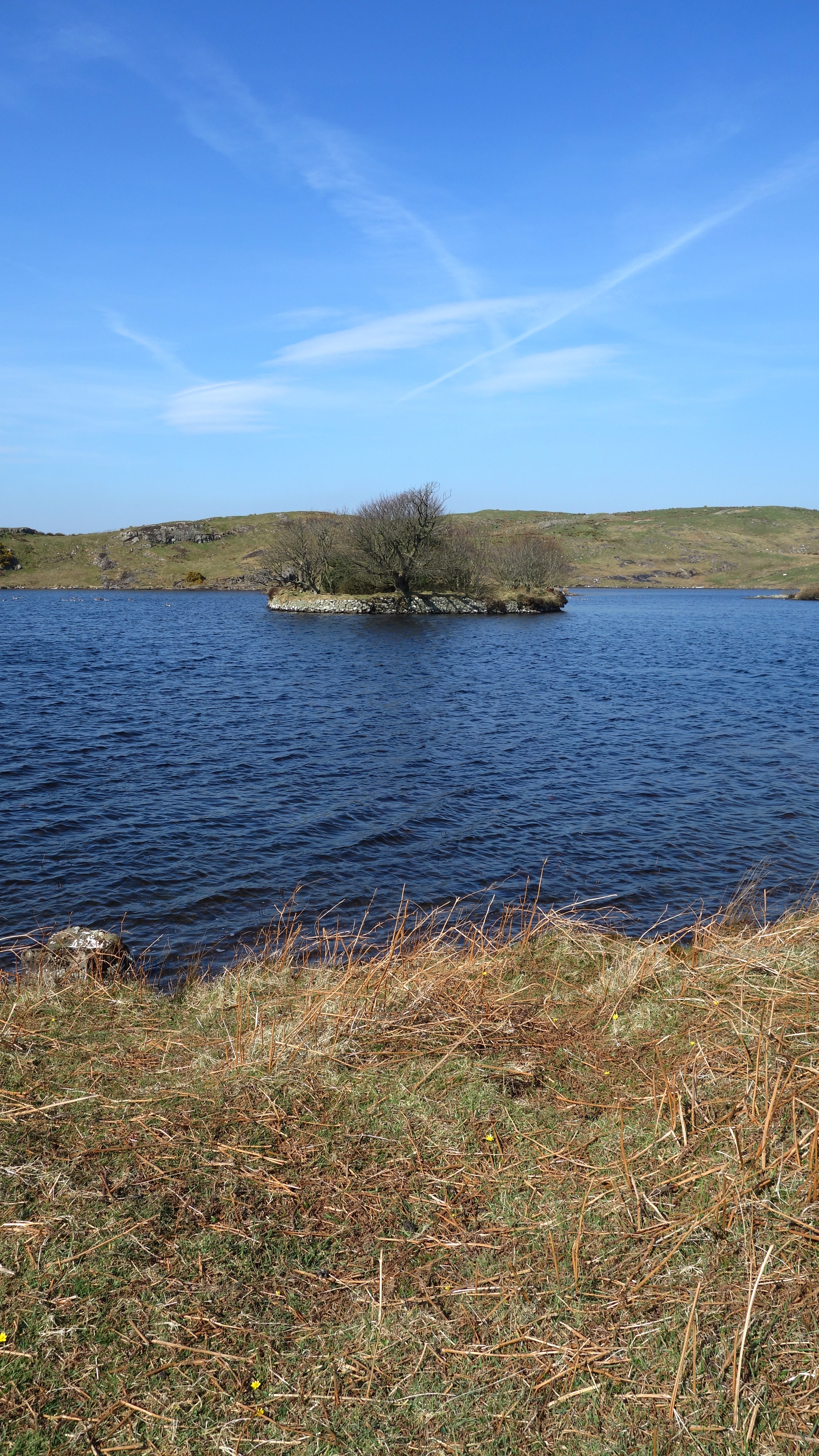
This is the view if you stop and walk a little down hill from the first car park. If you look towards the centre of the picture you should be able to see a white van, that is in no.2 car park. From there you can see the (tiny) road cutting diagonally away heading for the last car park. Be advised that all 3 are quite small so you should arrive early or you might have some reversing to do. You can see a small part of Rathlin Island in the distance to the left of the picture.

mb (3) mb (4)

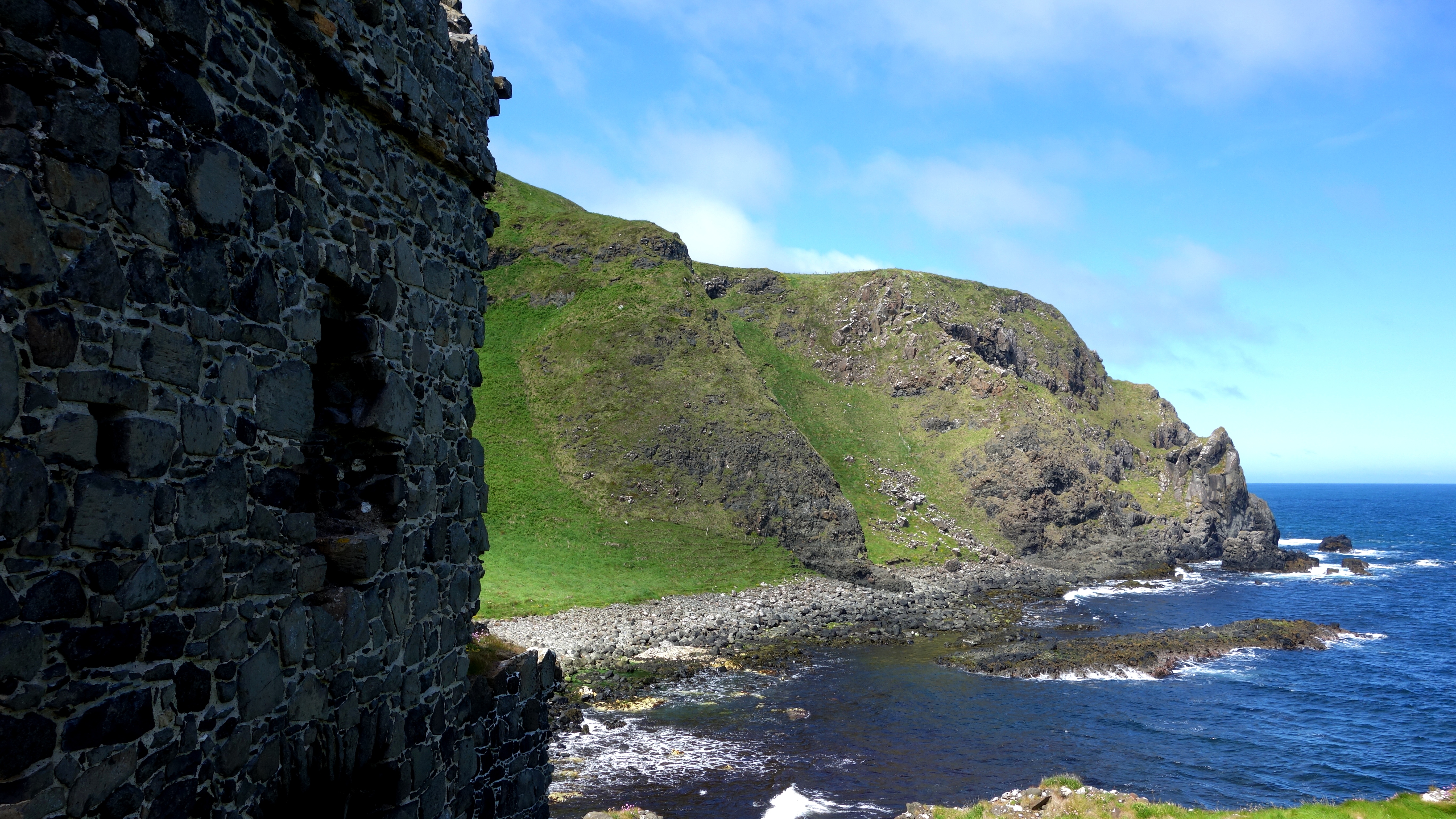
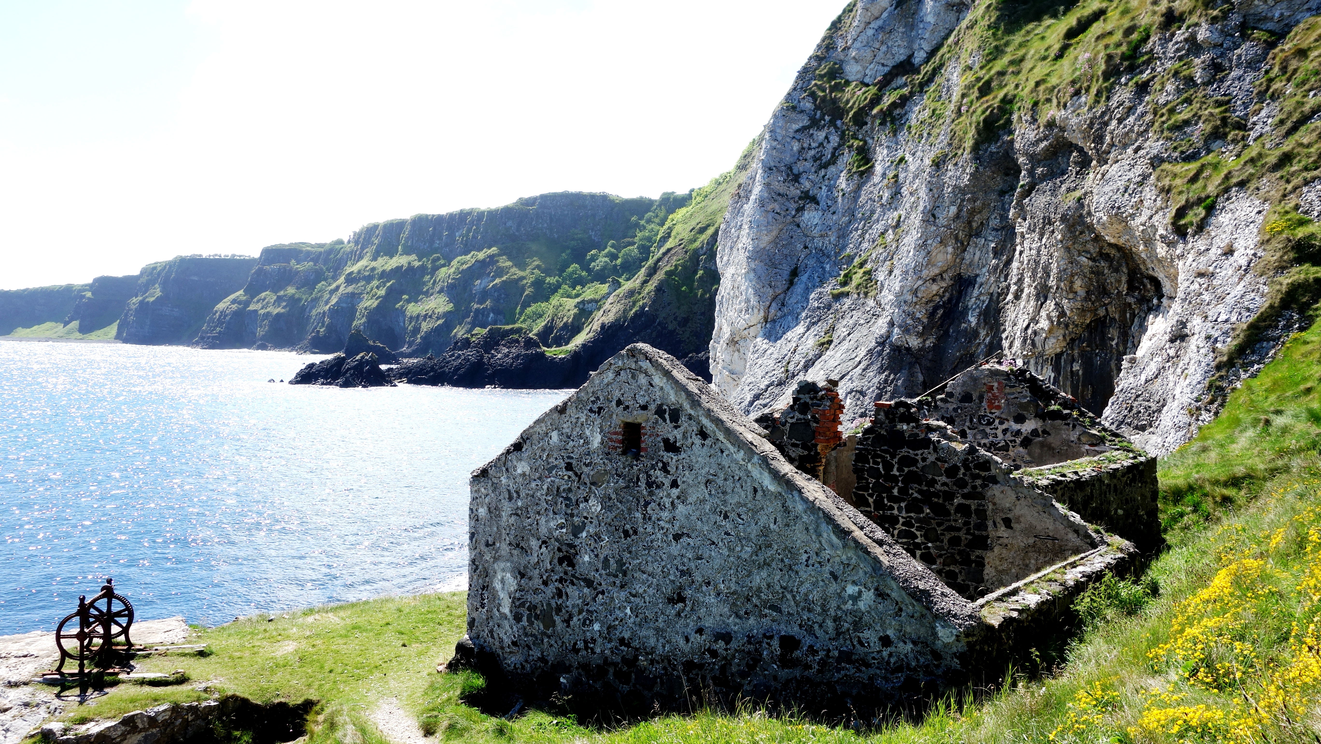
Theres a road that extends beyond the third car park but dont drive any further. It leads to a private cottage so just walk along here instead. On your way you will pass an old lime kiln still in good condition. They put alternate layers of limestone (from the hills above) and coal in it to burn and produce quicklime used in cement etc (the quicklime was raked out of the arch at the bottom after burning).

mb (5) mb (6)

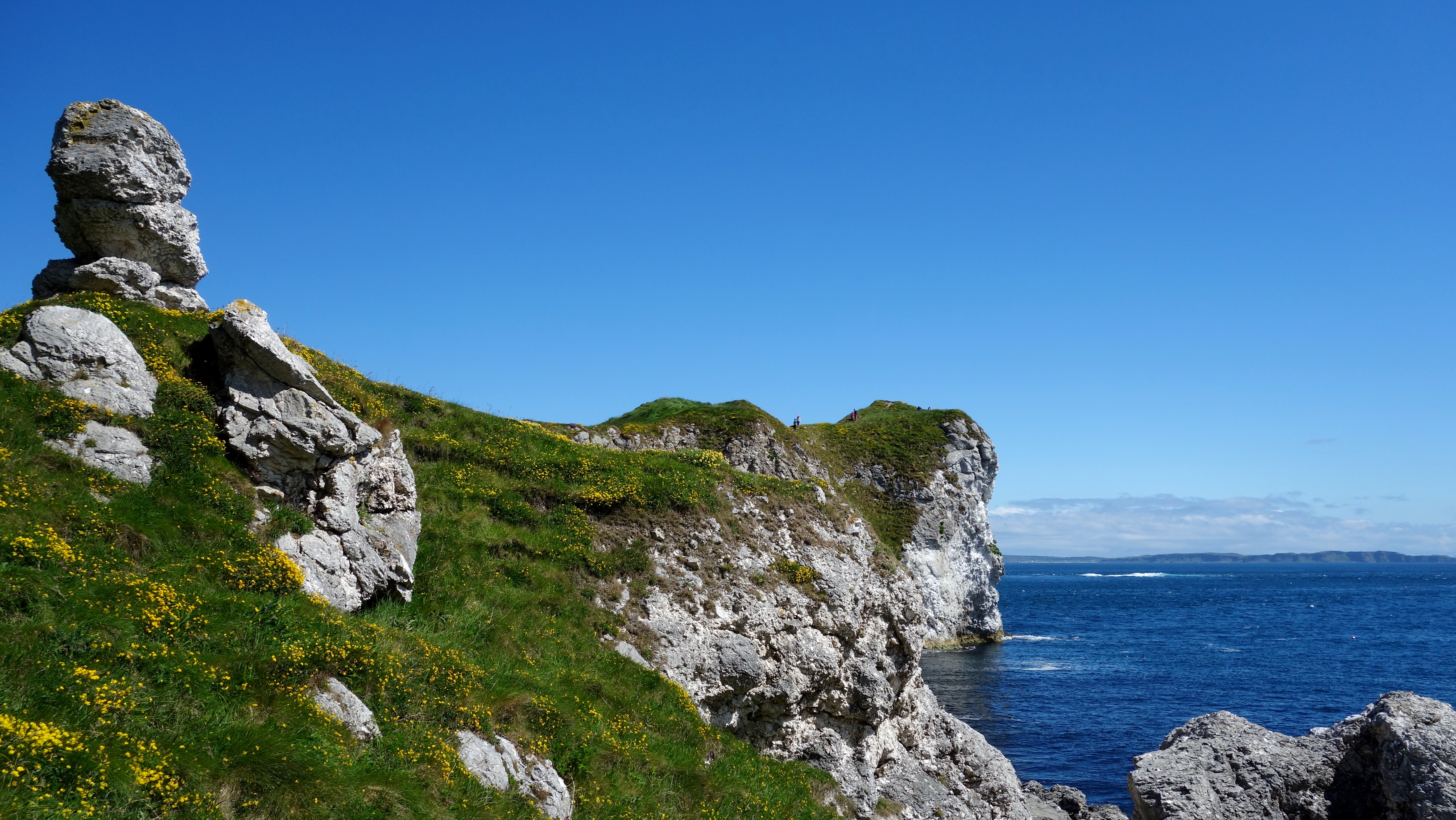
Look up here, about 200ft high above you are the limestone cliffs used in the kiln, hard to believe these were once under the sea. The little cottage is called a “Bothy” an old labourers cottage used either for kiln workers or fishermen I suspect. Sometimes these would be left open as a refuge, but this one is locked.

mb (7)  mb (9)

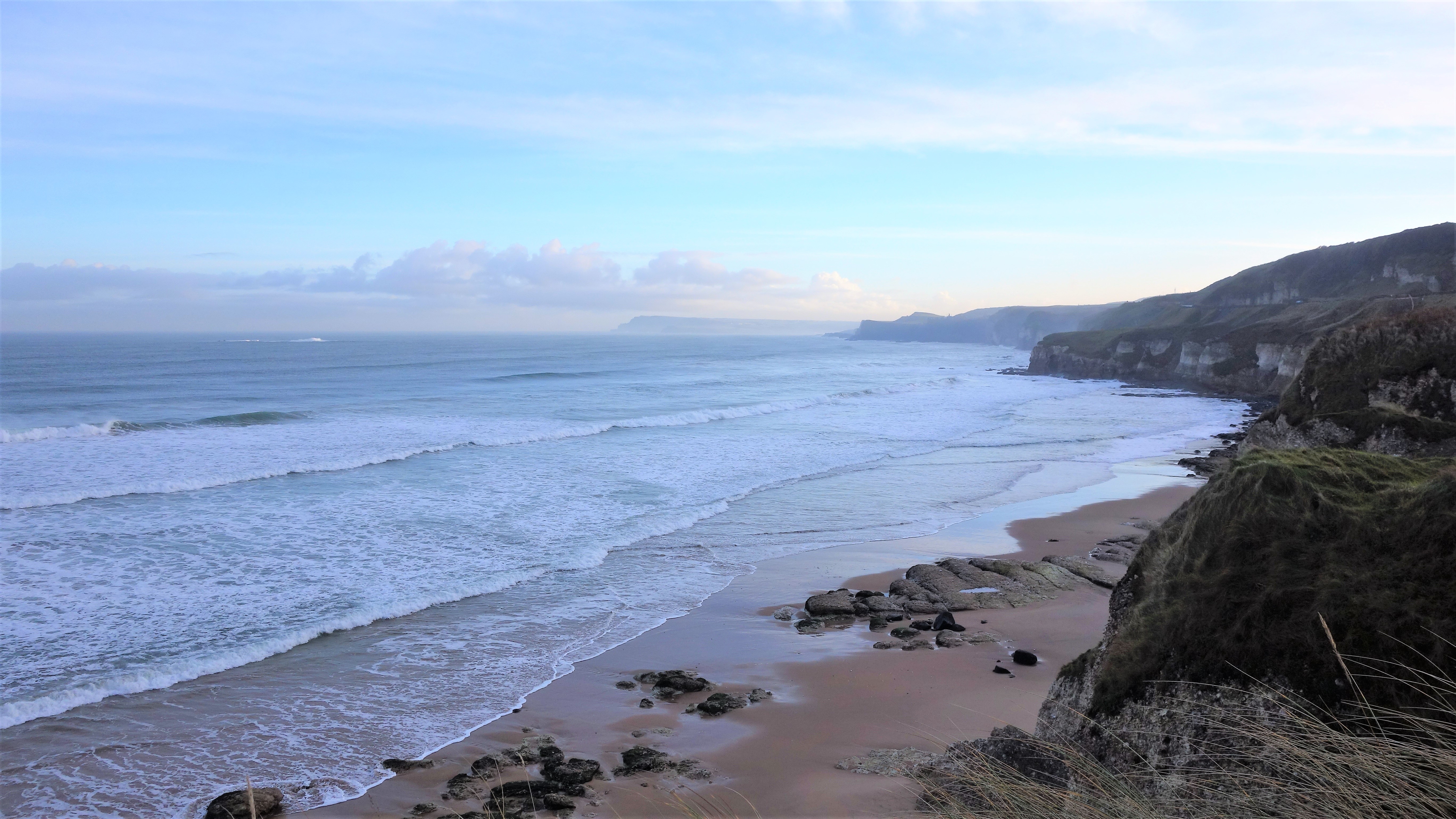
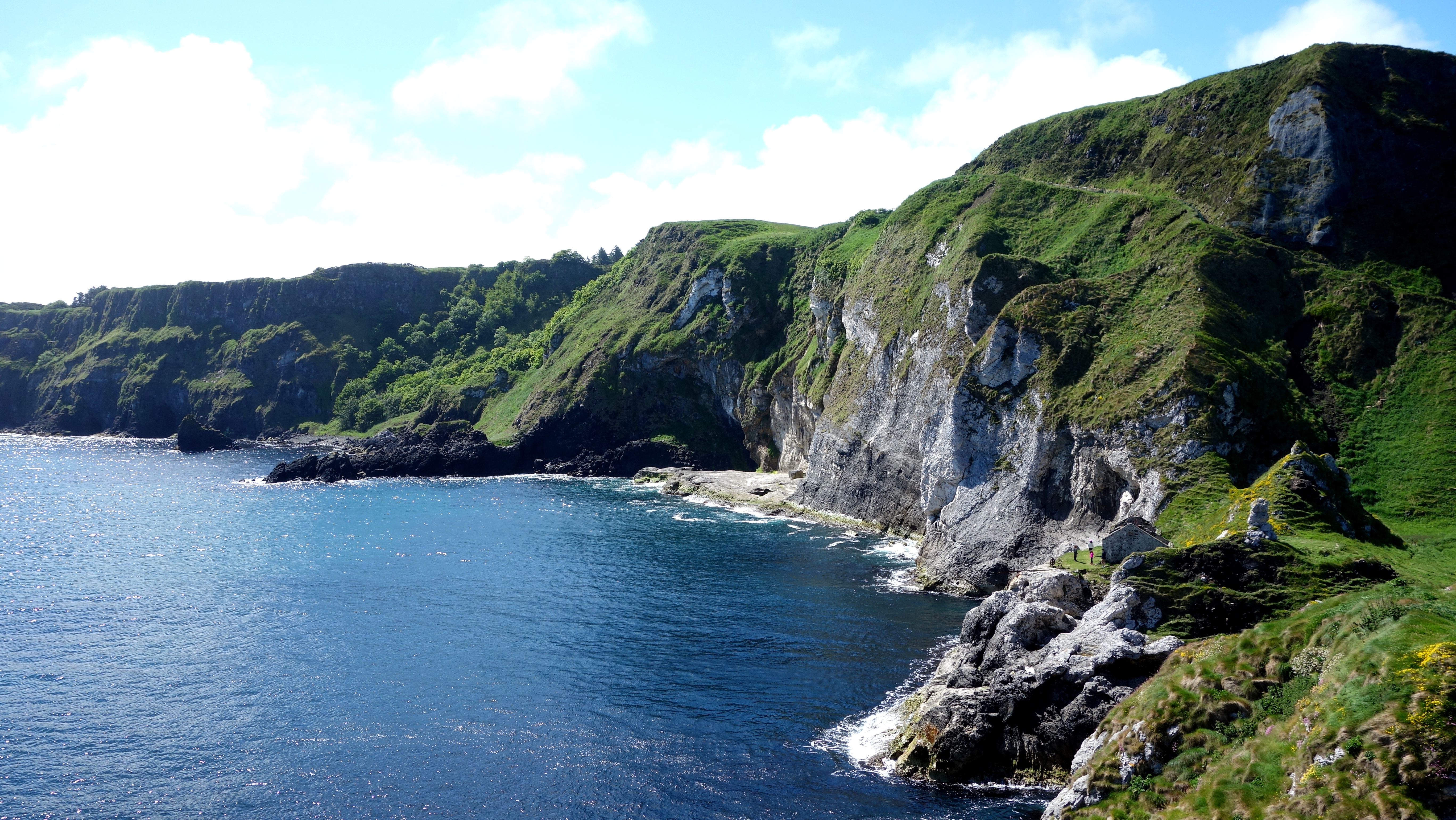
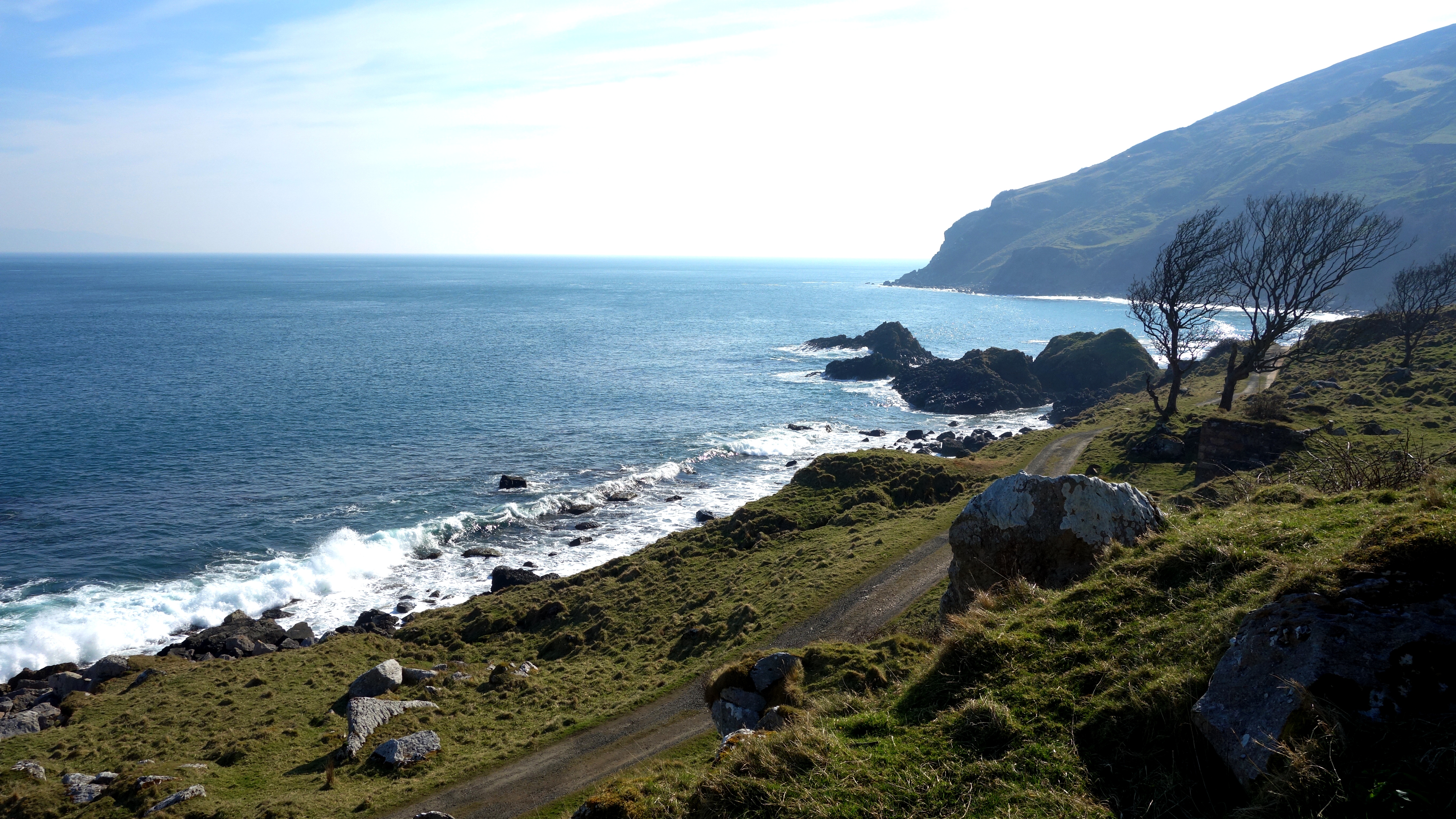
Over to your left are the remnants of some long lost building foundations, and part of a wall. Maybe a fishery or some ancient cottage. After that you will come to this private house. I reckon it must get a lot of photographs taken of it, as it adds a great focal point to the entire area. The bay and Torr Head lie before you.

mb (15) mb (11)

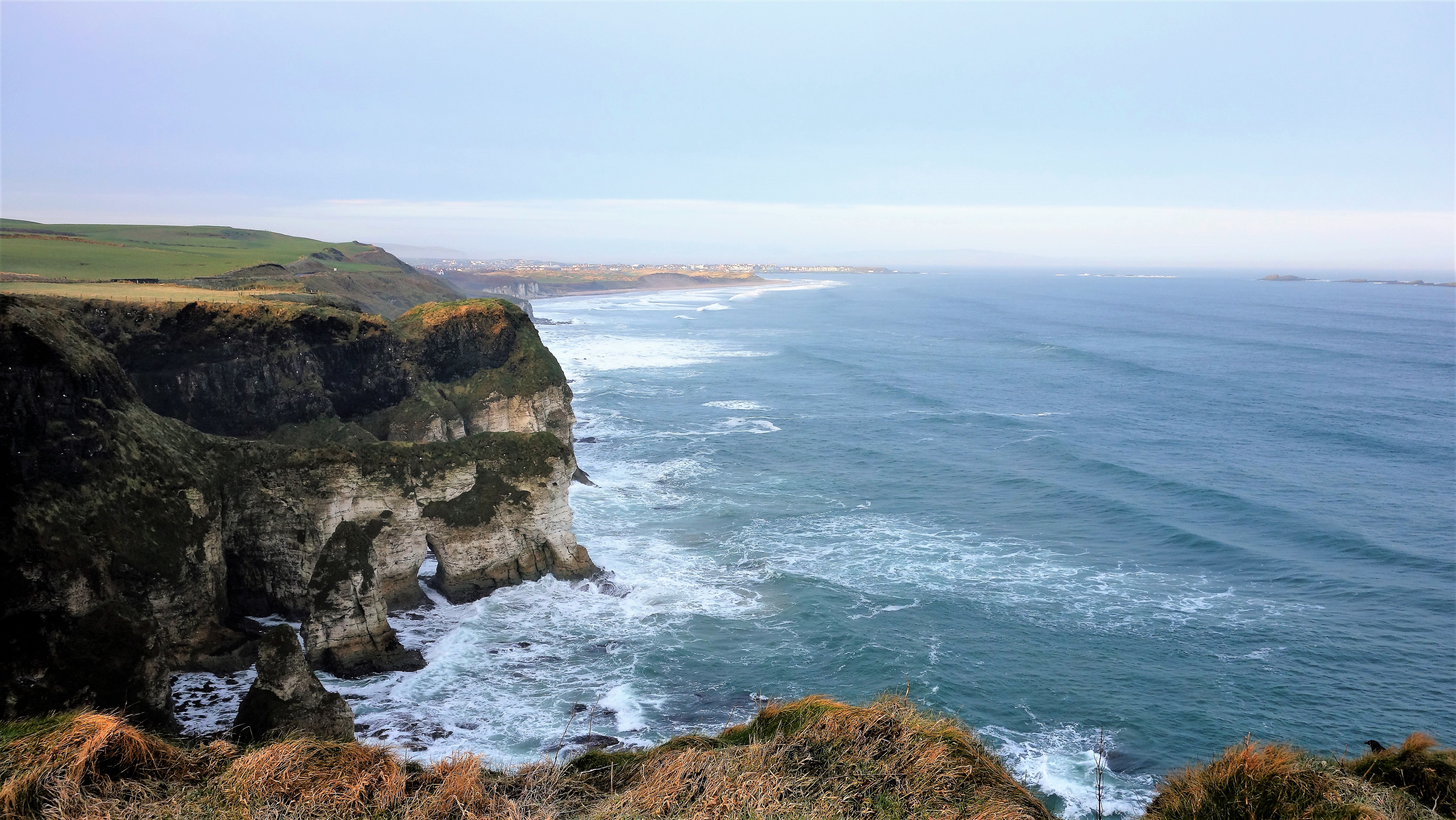
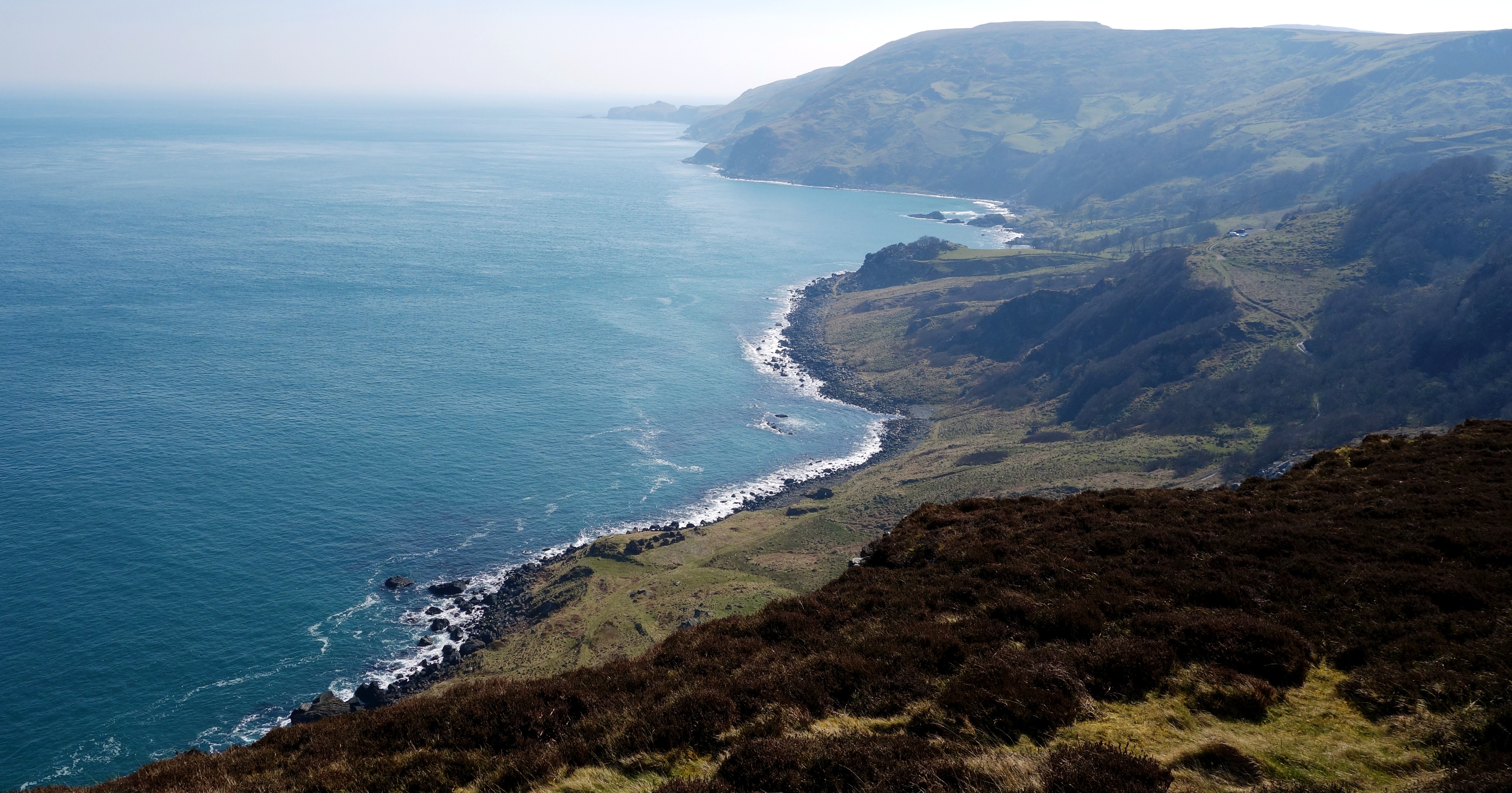
A place of natural beauty. Fair Head pointing towards the sky in the first picture. Torr Head in the second. You might just be able to see the shadow of Scotland on the horizon here.

mb (23)  mb (24)  mb (29)

Like a land that time forgot. Murlough Bay, County Antrim,  10th April 2015 🙂