A Summer Sunrise at Seahill (video).

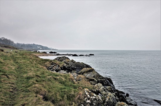
Well, I havent been here for such a long time, almost a year in fact, so I thought Id put up a small video I made of very close to where I live. It was filmed early one Summers morning a few weeks ago, on the shores of Belfast Lough, at Seahill County Down. Its not a part of the lough shore that a lot of people flock to (its neighbours Helens Bay and Crawfordsburn get all the crowds) but its a peaceful area that the locals really enjoy (theres also some great blackberry picking at this time of year). The music here is by Ceeys and the track is called Hiddensee.


Dundrum Castle, County Down.

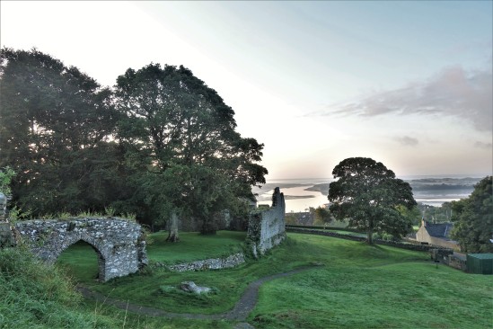
Thought to have been built around 1177, Dundrum Castle was part of the coastal defences controlling land routes from Drogheda to Downpatrick. Its just up a hill from the village centre of Dundrum and access is free (which is always great).  Dundrum is on the main road to Newcastle and if you wanted to kill two birds with one stone it has a decent car boot sale on Sundays but its better when the weather is good (summer being best of course).

dundrum castle (29)

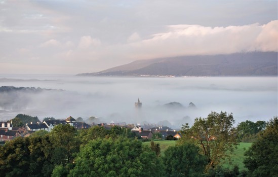
On the morning I arrived there was a pretty thick fog hanging over Dundrum Bay below the castle, but because it sits on a hill you could actually see over the top of the fog. You can see the town church spire poking up through the mist here.

Parts of the castle ruins look more like parts of an old house but I think there were numerous additions to the original castle down the centuries.  As the fog started to burn off I got some nice pictures of the place.

The tower set at the back of the castle grounds. The second picture shows the view through one of the windows of the tower over Dundrum Bay below.

dundrum castle (24)

The castle wall remains.

dundrum castle (58)

There are some woods to the left hand side of the castle (known as Castle Woods) that have a nice walking trail through them (seen just behind the fence here). The woods were planted nearly 200yrs ago and some information on them can be found here if youre interested: http://www.walkni.com/walks/382/dundrum-castle-woods-trail/ I had a great little morning (which as you can see turned out really beautiful) and an early visit like this (my first time) was certainly worth the trip.


Larrybane, Game of Thrones Location, Co.Antrim.

I took a drive up to a place called Larrybane yesterday which is halfway between Ballintoy (another GoT location, see my posts on it) and Carrick-a-Rede rope bridge. In fact to get there you have to follow the signs for Carrick-a-Rede and park up in one of the two car parks when you arrive (the first one you come to is for the bridge but theres a another one lower down thats better for Larrybane). The good thing is, Larrybane is completely free to access (the bridge is a pricey £7.50 each but hey, we all know by now that the National Trust is very good at robbing tourists eh? We’ve all become aware of their dodgy Giants Causeway shenanigans) and its really worth investigating – especially if youre a Game of Thrones fan and youve just visited Ballintoy mere minutes away. Larrybane was once a busy old limestone quarry and you can still see the remnants of the works buildings there.  

If you look at the top left corner of the first picture you can see the Game of Thrones set location at Larrybane. And in the second picture the same location yesterday with just my car parked there haha. This site was where Brienne of Tarth was first introduced to the show back in Season 2 (I think).

larrybane (4)

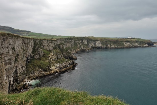
Theres a huge sweeping bay below the old quarry at Larrybane and you can actually see the point in the far distance where Carrick-A-Rede rope bridge spans the gap in the cliffs if you look very closely. Its that V shaped cut in the rocks just left of center towards the back of the picture. I have included a close up of it I took below.

larrybane (6)

Some of the old quarry ruins that remain. Looking pretty ominous against the cloudy November sky.

The view from the top of the headland is pretty spectacular I must say. It was a reasonably overcast day but some parts of the sandy bottom of the sea were a stunning turquoise blue. The island you see in the first picture is known as Sheep Island. I didnt see any sheep on it (theyd have to be able to swim to get out there) but it has some old folklore history yet its now designated as an area of special scientific interest and human access is prohibited during bird nesting season.

larrybane (2)

If you take one of the small trails through the grass at the top of the headland and look over the other side (be careful!), this is the view youll see. Its just as amazing as looking in the other direction and you might just be able to spot Ballintoy Church (which sits at the top of the road down to Ballintoy harbour) near the middle of the picture.

larrybane (8)

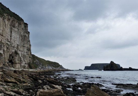
This was taken right down at the bottom of the cliffs (theres a crumbling old road to walk down) where the rubble and fallen limestone rocks from the quarry festoon the shoreline. You can see Sheep Island again in the background and I expect there may be some fossil hunting to be done down here at low tide.

larrybane (7)

This is a zoom in to the V shaped cut I mentioned in the rocks (on the second picture) where Carrick-A-Rede rope bridge crosses over the gap. You should actually be able to see the people crossing it. Its a bit of a walk to get to the bridge and once you do it youd likely not go again, but the walk there has everyone looking back towards Larrybane as the view behind you is so stunning. Personally I enjoyed visiting Larrybane (FREE!) just as much as the bridge. And it didnt have hordes of tourist bus passengers either walking in file to get there 😀


Random Stuff! Here & There.

This is just a few pictures I had lying around on my computer that Ive taken over the last year or two. I didnt have enough of each location for a full post (on the place) so Im just gonna dump them individually here. All pics are of course coming from Northern Ireland and as ever, are taken with a compact camera only 🙂


newcastle (4)

Early morning spiders, taken at Murlough Bay, near Newcastle Co.Down, a few weeks ago.

seahill (1)

Tranquility at Seahill. Only about 15mins walk from the beach at Helens Bay, but things are much quieter here and actually rather nice.


seahill (25)

Just a tree and high flying birds on a grey morning. Taken around about Craigavad (between Seahill and Cultra) County Down.


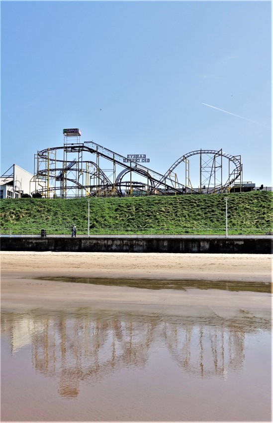
portrush 16th may 2018 (18)

Big Dipper reflections…


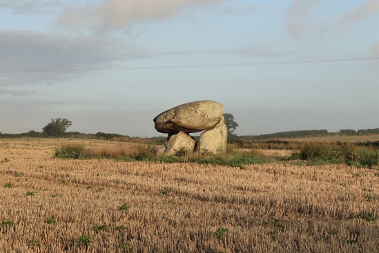
wateresk (6)

There are many dolmen (portal tombs) scattered around Northern Ireland, and several seem to be on farmers land. This is “Wateresk” which is right in the middle of a farmers field between Dundrum and Newcastle.

seahill (28)

A snail. Outside my house. Outside his house.

Ulster Transport Museum, Cultra, County Down

Sitting less than 7 miles from Belfast (with its own very handy train station which makes it easy to reach from the city), the Ulster Transport Museum aka The Ulster Folk and Transport Museum comprises of 2 distinct museums featuring both historical vehicles and old cottages, shops, and churches. It has won Irish museum of the year on occasion and remains one of the most visited attractions in Northern Ireland. You can buy a ticket to enter both museums (theres a short walk between them) or just pick the one you want to see. Among its many sights it includes a DeLorean car, which movie fans will know from the three Back To The Future films. DeLorean cars were built in a factory just a few miles outside Belfast (now gone).

Inside the transport museum, one of the old Belfast and Northern Counties Railway (BNCR) stations, a company which served the north-east of Ireland, and the huge No.800 locomotive “Maeḋḃ” which was one of the three largest and most powerful steam locomotives ever to be built and run in Ireland.


CULTRA (36)

One of the “101” Class diesel locomotives at the museum. This is No.102 “Falcon” which is the last surviving engine of its class (there were 3) after the other two were scrapped many years ago. I actually had a chance to drive this engine myself many years ago although I never saw it as this (original) colour (it was always blue). It was known simply as the “Hunslet” back then. Full details of this little engine and the fates of its two sisters are here:  https://en.wikipedia.org/wiki/NIR_101_Class


No, the blue bus on the left isnt actually a bus that ran on the road, its actually a Great Northern Railway “railbus” (built in 1928) that ran on the rails. Northern Ireland Railways had another one of these many decades later too but it wasnt exactly successful (lets just say). On the right are two Belfast Corporation buses with one being a diesel built in 1973 and one a trolleybus built in 1948. I think these are the only buses preserved in the museum.

CULTRA (73)

Tram No.249 would have been one of the first trams to use the electrified overhead line system through the centre of Belfast in 1905 (249 was built in 1905). Its seen here in its original colours and beautifully preserved.


CULTRA (95)

Both parts of the museum (I will put up a post about the folk museum one day too) are really worth visiting. Its a great day out and you can spend hours walking around looking at the various cars, planes, trains, buses etc and afterwards go for a lovely stroll into the countryside amidst the old preserved cottages, churches, and commercial buildings. Theres a cafe inside as well, but if youre trying to save some money its perfectly fine to bring a packed lunch and sit at one of the picnic benches there.

Ballintoy, Dawn to Dusk. Co. Antrim

Its not until recently that we actually discovered theres something of a hidden beach at Balintoy. We normally just drove down the hill into the car park and walked left along the shore, but it turns out theres a beautiful little cove halfway down the hill which you will find by taking a path that looks as if it belongs to someones house (its doesnt, but there is a house there).


I took these pictures very early one morning, having left Belfast about 430am. I visited the Dark Hedges first (the only way to get a photograph without people in it) and watched a stunning sunrise, all by myself. Brilliant.


You can see the sand is really quite red here, not something Ive seen very often on the beaches of NI.

Certainly worth getting up early for!


The second picture here was actually taken on a different day (and is of a sunset at Ballintoy and not a sunrise like these others). But such a great little spot it is.

Rostrevor & Cloughmore Stone, Co. Down

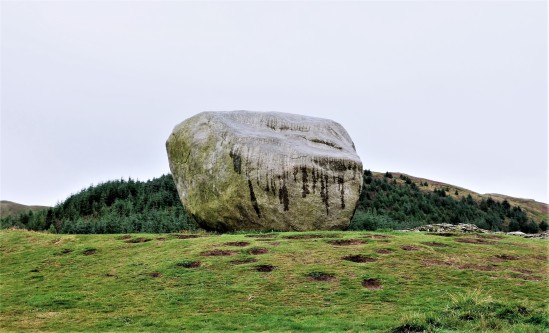
Cloughmore Stone, known locally as “The Big Stone” is a huge granite boulder that sits about 1000ft up on the side of Slieve Martin overlooking Carlingford Lough and the Cooley peninsula in County Louth and above the village of Rostrevor County Down.


rostrevor (18)

The name comes from the Irish “an Chloch Mhór” which means “the big stone” and its believed to weigh around 50 tonnes having been transported via glacial retreat from Scotland  (from an island in Strathclyde bay) and deposited here over 10,000yrs ago during the last Ice Age.


rostrevor (22)

Local legend has it that the stone was thrown from the Cooley Mountains on the other side of Carlingford Lough, by the giant Fionn mac Cumhaill (Finn McCool) who gets accused of a lot of things here in Northern Ireland haha (Lough Neagh, The Giants Causeway etc).


rostrevor (20)

The stone has many names and dates carved into it which go back centuries remembering those from history who have visited there. The Cloughmore Stone is a venue at Easter where the residents of Rostrevor would go up and roll their Easter eggs down the hill. A sort of a tradition for the Rostrevor residents.


rostrevor (31)

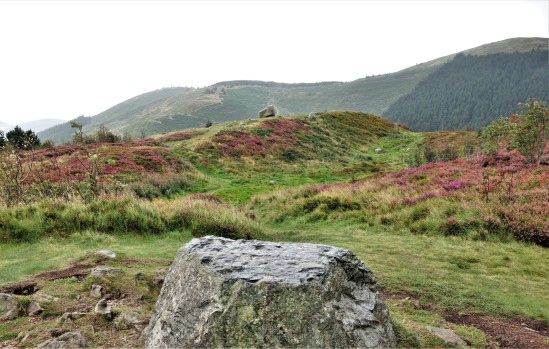
Quite impressive even on a rainy day like this one and there are some great views from the surrounding area.


rostrevor (29)

Theres a really nice walk up here through Rostrevor forest but it does get steep at times. Bring a lunch and rest at the top.


rostrevor (25)

North Coast Dreams (video) Slideshow of the Causeway Coast County Antrim.

Ive created a little slideshow video here of several pictures Ive taken around the North Antrim coastline. Its my first attempt at this so forgive its amateurish limitations. Locations seen include Castlerock, Binevenagh, Portrush, Portstewart, Dunseverick, Port Moon, Gortmore, White Rocks, and a glimpse of Dunluce Castle.


A 2017 Winters Morning. Portrush, White Rocks Co.Antrim

Even in Winter, on the windswept North Antrim coast (which gets a never ending battering from the Atlantic ocean), you can find peace and solitude away from the tourist draws of Belfast. No murals here, no big buildings with sunken ships, no relics of mans past, just a natural sight that hasnt changed for millenia.  


Shortly after sunrise on a cold, but beautiful February morning in 2017. White Rocks, near Portrush.


Stretching far off into the distance you would be looking towards the Giants Causeway and Fair Head here.


Slightly further up the coast from the White Rocks theres a small car park that has a stunning view. In one direction you can look back towards the rocks (and Portrush can be clearly seen) and in the other…. Dunluce Castle sits perched on its cliff top where its seen thousands of sunrises just like this one (click for large pictures).


A final view from above the White Rocks where the second biggest sand dune in Ireland towers above the beach as early walkers come out to take advantage of the sunshine.

Port Moon, County Antrim, Causeway Coast

A while ago I posted some pictures taken at Dunseverick Grasslands which involved climbing over the wall at the Dunseverick Castle layby and walking right around the headland there. Its a truly stunning walk and one thats hidden from the road so it can only be accessed on foot. There is another walk in the opposite direction however which is just as amazing towards a magical little bay called Port Moon.

moon-1

Port Moon has a long history of fishing going back well over 200 years and from 1830 nets were attached to the rocks offshore to catch Atlantic salmon on their journey to the river Bush for spawning. Crabs, lobsters and kelp were also harvested here.

moon-2

One of the crags jutting out into the sea on the walk to Port Moon, clearly showing the hexagonal columns which cover this area very close to the Giants Causeway (less than 5mls away).

moon-3 moon-4

Your first views of the little “Fish House” bothy seen from several hundred feet above Port Moon bay (and yes, you can climb down there if youre brave enough).

moon-6 moon-5

The surrounding area is simply stunning.

moon-7

After climbing down the looping path to the bottom of the cliff (it looks much more scary than it actually is, but be careful if its been raining as it can be slippery) you arrive at the old Fish house which now operates as a bothy (a small hut or cottage used as a refuge) which you can arrange to stay at if youre feeling adventurous (see here: http://www.canoeni.com/canoe-trails/north-coast-sea-kayak-trail/access-point/port-moon/ ). The building used to house all fishing operations at Port Moon but had fallen into disrepair until it was resurrected as a bothy in 2011. There are some pictures of the inside here https://www.hikersblog.co.uk/an-overnight-stay-in-port-moon-bothy/ but normally its locked.

moon-9 moon-8

Looking out across the bay from the Port Moon shore. Not bad for a wintery February morning!

moon-10

The bothy seen from the opposite side of the crescent shaped (moon shaped) bay.

moon-11 moon-12

Port Moon, a magical little place now deserted and haunted by the ghosts of its fishing past. Its really worth seeing and its very much an undiscovered gem of NI that most residents wont even have seen. Dunseverick Castle may not be much to look at but once over that wall and walking either left or right youll surely be impressed.