Ulster Transport Museum, Cultra, County Down

Sitting less than 7 miles from Belfast (with its own very handy train station which makes it easy to reach from the city), the Ulster Transport Museum aka The Ulster Folk and Transport Museum comprises of 2 distinct museums featuring both historical vehicles and old cottages, shops, and churches. It has won Irish museum of the year on occasion and remains one of the most visited attractions in Northern Ireland. You can buy a ticket to enter both museums (theres a short walk between them) or just pick the one you want to see. Among its many sights it includes a DeLorean car, which movie fans will know from the three Back To The Future films. DeLorean cars were built in a factory just a few miles outside Belfast (now gone).

Inside the transport museum, one of the old Belfast and Northern Counties Railway (BNCR) stations, a company which served the north-east of Ireland, and the huge No.800 locomotive “Maeḋḃ” which was one of the three largest and most powerful steam locomotives ever to be built and run in Ireland.


CULTRA (36)

One of the “101” Class diesel locomotives at the museum. This is No.102 “Falcon” which is the last surviving engine of its class (there were 3) after the other two were scrapped many years ago. I actually had a chance to drive this engine myself many years ago although I never saw it as this (original) colour (it was always blue). It was known simply as the “Hunslet” back then. Full details of this little engine and the fates of its two sisters are here:  https://en.wikipedia.org/wiki/NIR_101_Class


No, the blue bus on the left isnt actually a bus that ran on the road, its actually a Great Northern Railway “railbus” (built in 1928) that ran on the rails. Northern Ireland Railways had another one of these many decades later too but it wasnt exactly successful (lets just say). On the right are two Belfast Corporation buses with one being a diesel built in 1973 and one a trolleybus built in 1948. I think these are the only buses preserved in the museum.

CULTRA (73)

Tram No.249 would have been one of the first trams to use the electrified overhead line system through the centre of Belfast in 1905 (249 was built in 1905). Its seen here in its original colours and beautifully preserved.


CULTRA (95)

Both parts of the museum (I will put up a post about the folk museum one day too) are really worth visiting. Its a great day out and you can spend hours walking around looking at the various cars, planes, trains, buses etc and afterwards go for a lovely stroll into the countryside amidst the old preserved cottages, churches, and commercial buildings. Theres a cafe inside as well, but if youre trying to save some money its perfectly fine to bring a packed lunch and sit at one of the picnic benches there.

Autumn around County Down

I’m a bit late putting these up as Winter is well and truly upon us but having found them on my camera I thought Id stick them here as a reminder of Autumn 2016 which has left us for ever.

Picture 1: Queens University Belfast, Picture 2: The Ulster Museum (Botanic Gardens), Picture 3: Palm House (Botanic Gardens).


Picture 1: Tree shadows in Botanic Gardens, Picture 2: Yellow tree at Queens University Belfast.


Holywood, County Down. Looking over Belfast Lough just after an Autumn sunset.


autumn-8

A burst of yellow @ Ballymenoch Park, Holywood, Autumn 2016

Divis & The Black Mountain Belfast

Providing the back drop for the city of Belfast, Divis Mountain was the filming location for several scenes in the movie “Dracula Untold” and there’s certainly a lot of old history up here. On a clear day there are views of Strangford Lough, the Mournes, The Sperrins, as well as Scotland and Donegal. The area is covered with 1,500 acres of upland heath and blanket bog and its home to a wealth of flora and fauna and archaeological remains. There are several easy walks around the area too with wooden paths and tarmacked routes allowing almost anyone to enjoy the fresh air and greenery above Belfast.

divis-1

After arriving at the car park youll see this welcome sign. Entrance is free.

divis-3 divis-5 divis-4

There are 4 routes around the area. Ranging from an easy 1 mile amble, to something a bit more strenuous (4 miles).

divis-8 divis-6

None of the routes involve any real climbing apart from a stile or two.

divis-14 divis-9 divis-13

Depending on the time of year, there’s some wonderful bursts of colour up here.

divis-11 divis-10

Which leads to fantastic views over the entire city.

divis-15

So next time youre in Belfast for a day or two take a walk across the Divis & Black Mountain trails (theres a cafe for refreshments too – check opening times etc here: https://www.facebook.com/diviscoffeebarn/ )

Titanic Belfast, Titanic Quarter & SS Nomadic

Once again Ive fallen a bit behind with posting a months pictures as work (and our new house needing decorating) just got in the way. Sadly my May 2016 post sunk into oblivion and never came to fruition but (again) I really want to get things back on track particularly now that I’m paying for the website (as my free WordPress allowance burst its seams with the amount of pictures Ive posted haha).

So talking of things that sunk (see what I did there?) its time for a visit to the hugely popular Titanic Centre area of Belfast although I didn’t actually visit any of the exhibitions there, I just wandered around outside snapping the vast area of land it covers. But it was a really enjoyable walk and it was totally free.


titanic (7)

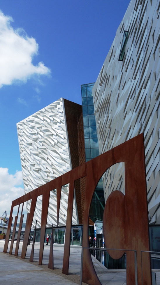
The huge Titanic sign at the main entrance to the exhibition centre. There’s car parking below the centre that costs £1.50 per hour and there’s a cafe inside too if you just wanted to visit the area and pop in.


titanic (2)  titanic (6)

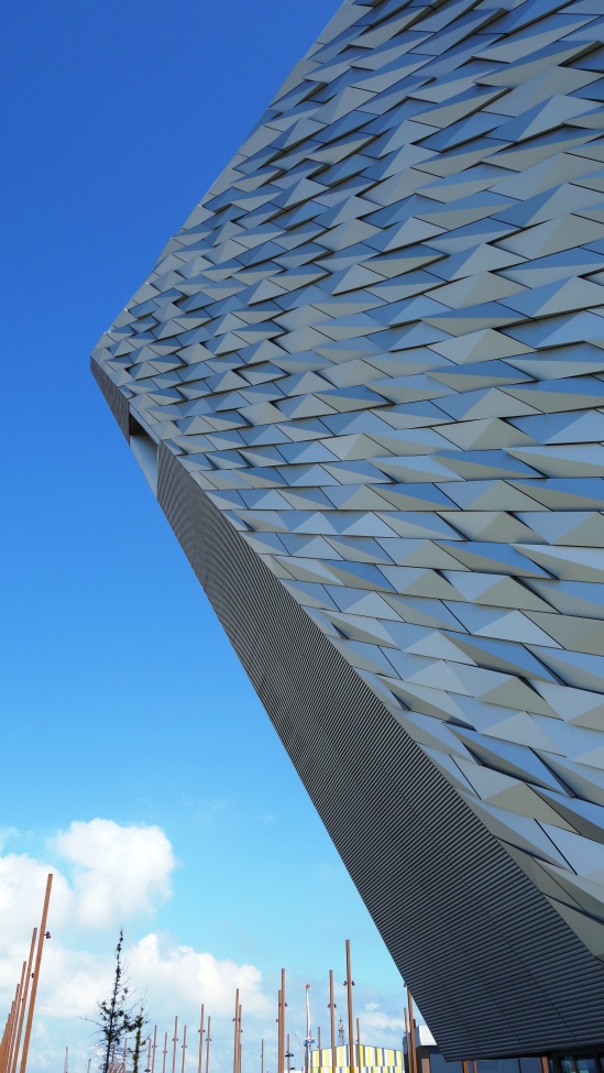
The June weather was wonderful on the day of my visit, and the Titanic building itself is pretty impressive dominating the skyline with every angle offering a different photo opportunity.

titanic (4)

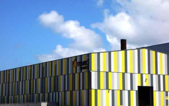
Around the back of the Titanic building is Titanic Studios which used to be called the Paint Hall where all the components of the ships built here were painted and kept in climate controlled conditions. Today however, its actually much more interesting with the building becoming one of the biggest film studios in Europe, and being the filming location for movies and TV series such as City of Ember, Your Highness, Series 1 of Game of Thrones, and the very recent release of Ben Wheatleys “High Rise”.

titanic (5)

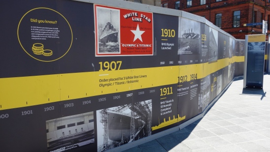
There are many signs and information boards around the area so you really don’t have to pay to see any of the exhibitions in the main building if you’re on a tight budget (and you can of course enter the building for free too).

titanic (14)

Please don’t climb up behind this lady whilst singing a Celine Dion song 🙂


titanic (12)

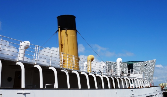
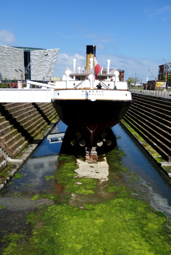
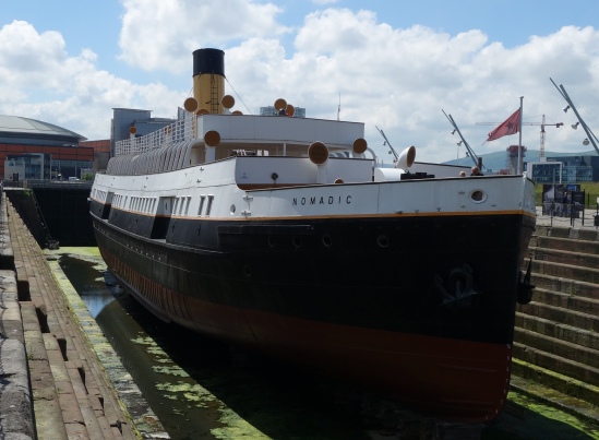
Across the road and facing the front of the Titanic Centre you can also visit the SS Nomadic which was tender to the Titanic and its also the last White Star Line surviving ship in the world.

titanic quarter (52)

The SS Nomadic has been fully restored and for less then £8 you can go on board and look around.

titanic (9)

titanic (13)

The Nomadic really has been restored to an excellent condition and looks fantastic sitting in the summer sunshine.

titanic (10)

Nomadic sitting on a shallow sea of algae. You can see how close it is to the Titanic building just to the left. Its a great little area for strolling around for a few hours for sure.

titanic (1)

And before I left I just had to snap one of these iconic yellow monsters piercing the blue sky of Belfast on such a lovely June day.

Helens Bay, Co.Down 10th January 2016

I haven’t posted anything in a while with a few personal things going on, but new year brings new intentions to get things going again, and as ever, the idea is to show just what Northern Ireland has to offer beyond its troubles of the past and its big ship that sunk in the night. There’s much more to our tiny country than those black taxis around tainted murals, or even the wonderful Giants Causeway. Have a look and see what has lay hidden for decades from most travellers eyes, and where most sights are never more than 120mins apart.

All photos were taken with only my Sony compact camera, so my pictures actually are of what you will see (no hyper-realistic SLR pix here as I prefer to show reality). Heres to a great new year of 2016 and I hope it brings each and every one of you much happiness 😀


HELENS BAY – SEAHILL Coastal path, on the evening of January 10th 2016


Helens Bay - Seahill 10.01 (1)

The weather in the north of Ireland (in fact all of the UK and Ireland) has been the wettest ever on record this winter, so we’ve barely seen the sun in weeks. Last night however there was a little glimmer of gold as the day began to fade so we went out for a walk along the shores of Belfast Lough and grabbed a few pics.


Helens Bay - Seahill 10.01 (2)


You cant really see it here, but this is looking across the lough towards Carrickfergus from Helens Bay


Helens Bay - Seahill 10.01 (4)

A rocky beach between Helens Bay and Seahill


Helens Bay - Seahill 10.01 (5)

You might just be able to see a little bench to sit on to the left here, but we decided not to given it was very, very cold!


Helens Bay - Seahill 10.01 (3)

After all that rain, much of the path was muddy and puddled, but it made a nice feature in this picture.


Helens Bay - Seahill 10.01 (6)

Daylight almost gone now, the last embers of light fading into a January night.

Cave Hill, Cavehill, Belfast, County Antrim

Cave Hill, sometimes spelt as Cavehill, is a basaltic hill overlooking the city of Belfast. It forms part of the southeastern border of the Antrim Plateau. Historically it was known as Ben Madigan, which is derived from the Irish Beann Mhadagáin, meaning “Madagán’s peak”—so named after a king of Ulster called Madagán who died in 856AD.

All of Belfast can be seen from its peak and Cave Hill is thought to be the inspiration for Jonathan Swift’s Gulliver’s Travels as Swift imagined that Cave Hill resembled the shape of a sleeping giant safeguarding the city.

cave hill belfast (1) cave hill belfast (2)

Cave Hill rises to almost 370 metres (1200 ft) above sea level. Most of its lower east side lies on the Belfast Castle estate. The slopes of Cave Hill were originally used as farmland but, from the 1880s, a major planting exercise was undertaken, producing the now familiar deciduous and coniferous woodland landscape. Belfast Castle estate was given to the City of Belfast by The 9th Earl of Shaftesbury in 1934.

There are three large caves. The lowest is 21 feet long, 18 feet wide and varies from 7 to 10 feet in height. Above this is another cave; 10 feet long, 7 feet wide and 6 feet in height. Above this is the third major cave, said to be divided into 2 unequal parts, each of which is more extensive than the larger of the other caves, but the ascent is notoriously dangerous and thus few venture up to it. The caves are entirely man-made, and it is thought that they were originally excavated for iron-mining.

cave hill belfast (3) cave hill belfast (5)

This is the easiest cave to access and the most easily visible from below. The climb up to this point (from the grounds of Belfast Castle) is probably the most tiresome part of the Cave Hill climb but its not beyond most peoples ability. Bring some water if you’re going up in the warmer months (and a coat in the colder ones!).

cave hill belfast (6)

The views from the top are pretty amazing with one side of the water being County Antrim, and the other County Down. You can see all of Belfast Lough and the ship here is the Stenaline service heading for Scotland (the vague shadow on the horizon). The chimney to the distant left of the picture is Kilroot power station which provides electricity for one third of Northern Ireland, and in the bottom foreground of the picture you can see Belfast Zoo (the brown bear cage I think).

cave hill belfast (15) cave hill belfast (9) cave hill belfast (12)

McArt’s Fort on the summit of the hill, is an example of an old ráth or ring fort. It is protected on one side by a precipice and on the others by a single ditch, 10 feet in depth and 25 feet in width. The enclosed area is nearly level. The flat top of the fort is 150 feet from north to south, and 180 feet from east to west. It is believed that the fort’s inhabitants used the caves to store food for the winter and may have served as a refuge during times of attack. If you look towards the bottom of the last picture you can see a cave there.
cave hill belfast (4) cave hill belfast (8) cave hill belfast (7)

Its certainly a nice trip out here as you get to explore the castle grounds before your climb (even entertain the kids with its adventure playground too) and to have a bit of wilderness so close to a city is pretty unique. Who would have thought, that even in March (and NI) you can get out and enjoy the countryside 🙂

cave hill belfast (11)

The residential neighbourhood at the foot of Cave Hill’s entrance is derivatively known as Ben Madigan, with street names to match, and is a wealthy semi-outer city, semi-suburban area. The name ‘Ben Madigan’ can also be found attached to buildings, schools etc. close to the area, e.g. the Belfast Royal Academy has the Ben Madigan Preparatory School on the Antrim Road.

During World War II, a bomb dropped during a German bombing raid on Belfast exploded, causing a large crater near the grounds of Belfast Castle. It is understood that RAF Bomber Command was situated on Cave Hill in the early years of WWII before relocating to Castle Archdale in County Fermanagh. On 1 June 1944, an American Air Force B-17 bomber crashed into Cave Hill during heavy fog, killing all ten crew instantly. The incident inspired Richard Attenborough’s film, “Closing the Ring” and some scenes of the film were shot on Cave Hill.

cave hill belfast (13) cave hill belfast (14)

One for you cloud spotters, and the rolling Belfast hill walkers.