Glenariff Forest Park, County Antrim, February 21st 2015

Glenariff Forest Park covers over 1000 hectares and is within Glenariff, one of the nine Antrim glens. We stopped off from a cold (and actually a little bit dangerous) drive through fresh and falling snow on our way to Cushendall. The roads hadn’t been gritted, and a few times our car started to slide ever so slightly away from us. We thought it best to pull into the park in the hope the weather would improve. Which, given the slowly rising temperatures it eventually did. Sadly the park was closed that day, so we had to leave the car across the road and walk in (a few other local explorers had done the same). We then took the few pictures you see below, but chose not to go too far into the park as the weather was changing every 15 minutes from sunshine to snow. You can get a few more details on Glenariff here: http://www.nidirect.gov.uk/glenariff-forest-park and (as ever), the fantastic WalksNi site gives details of walking routes around the park here:  http://www.walkni.com/walks/234/glenariff-forest-park-scenic-trail/

glenariff park (14) glenariff park (15)

Sadly the park was closed, but there’s no issues walking around inside if you can find a place to leave your car (space is limited as you shouldn’t block the access gate).

glenariff park (11)

I’m not actually sure what this building is. It sits down in a valley beside the river as you walk in, so I expect it was a mill in the distant past.

glenariff park (12) glenariff park (1)

On so many of our adventures we see no one, which we both kinda like. During the Summer, so many of these places would be a hive of activity, but out of season you can regularly find yourself feeling like you’re the last person on Earth haha. On the second picture here you can see the next wave of snow coming at the bottom of the valley…

glenariff park (2)

Now the sky is getting very dark….

glenariff park (4) glenariff park (3)

A little wooden cabin that was built in the 70s (with funding from a local childrens school). A good place to shelter given the ever-so-changable Northern Ireland weather!

glenariff park (6) glenariff park (5)

After the snow had stopped the Sun appeared again, not picnic weather just yet, but Glenariff looked amazing.

glenariff park (7) glenariff park (8)

I know Ive said it before, but the North of Ireland hides so much beauty, not often recognized given our past. But things are now changing for us in terms of visitor numbers, and sights like this will soon be a draw all year round (one hopes) for those people looking a holiday somewhere different. I know NI is seen as having quite limited access time (based on its weather), but I started this blog at the end of Summer 2014, and its never been an issue getting out and enjoying the countryside all through the Autumn and Winter.

glenariff park (10)

Just 40 minutes after the dark, snowy sky on the earlier pics above, this was the scene before us. I guess our weather changes just as quickly from bad to good then, as it does the other way around :-))

Whitepark Bay, North Coast, County Antrim

White Park Bay (also spelled Whitepark Bay) is a bay and three-mile long beach located near Ballycastle, County Antrim on the north coast along the Giant’s Causeway Coastal Route.

Whitepark Bay hosts a great display of Ireland’s geological past with many fossils scattered at the Southern end of the beach which can be found pretty easily. On the day we were there, we found 7 rocks within 15 minutes containing fossilized remains. The cliffs on both West and East sides of the bay are composed of Upper Cretaceous (Santonian- lower Maastrichtian) chalk. The chalk itself is a form of limestone composed almost entirely of Calcium Carbonate. This chalk formed late during the Cretaceous period, a time when many marine transgressions took place, and much of the continents were under water- as was Ireland. The cliffs at White Park Bay are rich in fragments of the belemnite, a form of early squid. You can spend hours here combing the white beach and examining the little white rocks (the fossils only seem to be in those). The sound is amazing as they roll in and out with the waves.

whitepark bay (6)

The first sign we saw after parking our car in the car park.

whitepark bay (11)

Across the meadow to your left is Portbradden in the distance.

whitepark bay (7) whitepark bay (5)

As you saw on the sign above, this used to be an 18th Century “Hedge School” for young gentlemen. Based on the sign on the building now though, it seems some non-gentlemen damaged it in the past. I’m not really sure however what the sign is referring to (to be honest) as the building looks as if its been a ruin for a very long time. Anyway, you’ll pass it on your way down to the beach.

whitepark bay (1)

More information on this special beach on the North coast

whitepark bay (19)

Reflections of the dramatic Winter sky on the wet sand at Whitepark Bay. Portbradden (again) in the distance.

whitepark bay (45) whitepark bay (44)

The pictures here probably don’t do the place justice, but when the sun comes out, the beach just glows white. And any one of those stones you see here could contain a real fossil.

fossils

This is a picture of a few we took home. Maybe not the greatest fossils ever, but we found these while hardly even looking. And that shell at the back is actually completely fossilized, its solid stone, (even though it looks just like a normal shell). Amazing stuff!

whitepark bay (46)

Youll see this sign as you leave Whitepark. I expect it only means you cant take the sand or fine gravel away (not one of the millions of rocks) as the tourist info for the Bay encourages hunting for them. We cant wait to go back.

Loughbrickland, Slieve Croob, Legananny Dolmen and Windy Gap County Down.

Yes, the title above is likely a bit of a mouthful for those visiting from foreign shores, but these place names are said pretty much phonetically so don’t worry haha. On a chilly, but bright February morning (2015), I set off for a drive to see where I would end up. The intention was to locate at least one of the ancient burial “Dolmen” dotted around the South County Down area and I guess I managed to find one even if it was almost by accident. It looks as if there are at least seven in the surrounding countryside, and I find it truly fascinating that these monuments are still standing after nearly 5000 years. Northern Ireland’s ancient history seems very well hidden though!

loughbrickland (1) loughbrickland (3)

These are just a couple of pictures I took of Loughbrickland Lake in County Down while going South. Its just off the main Belfast to Dublin (A1) road and as I hadn’t seen it frozen over before I swerved off the motorway and grabbed a few shots before heading on. The lake holds brown and rainbow trout and can be fly fished during the season.

slieve croob (1)

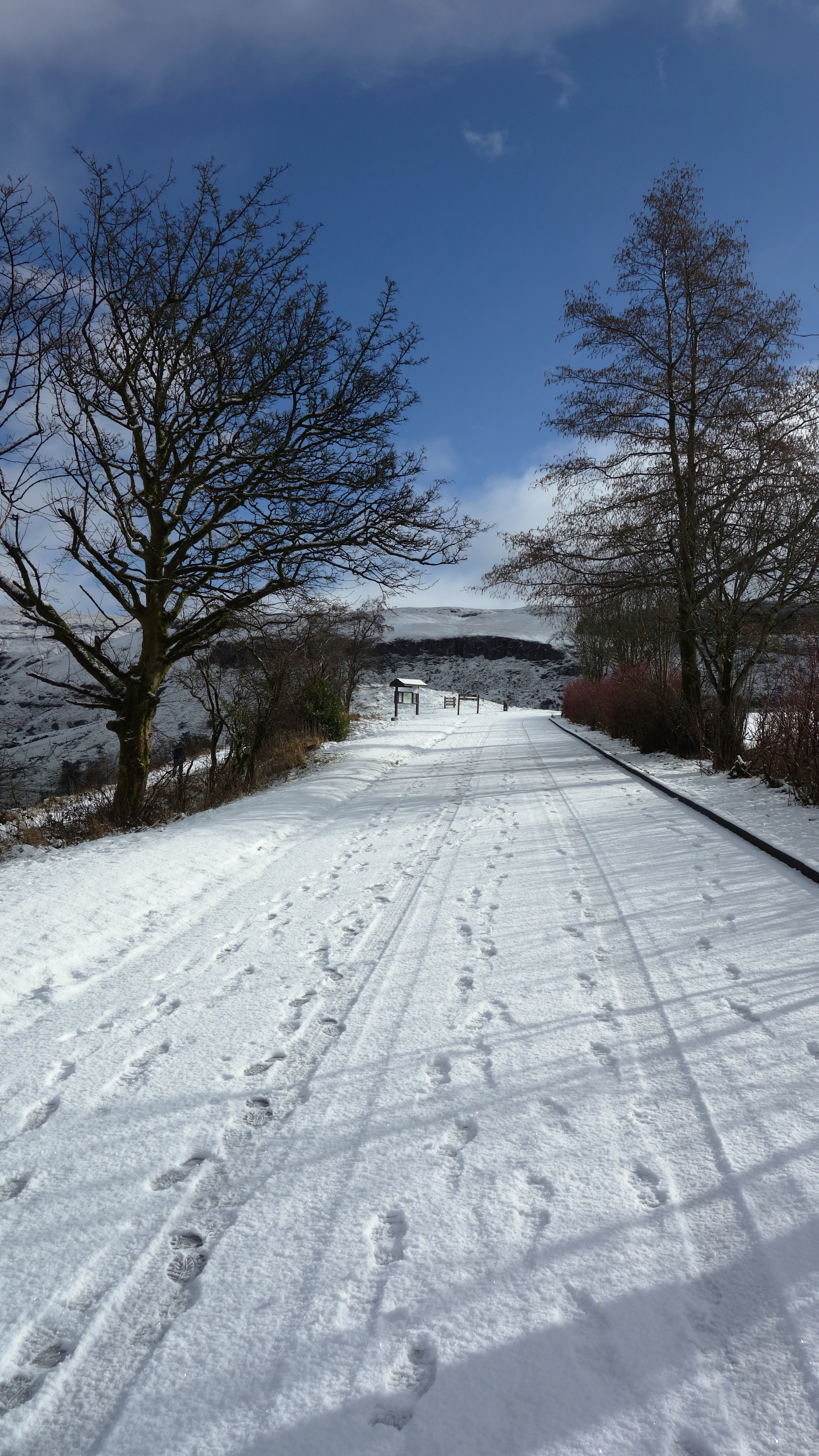
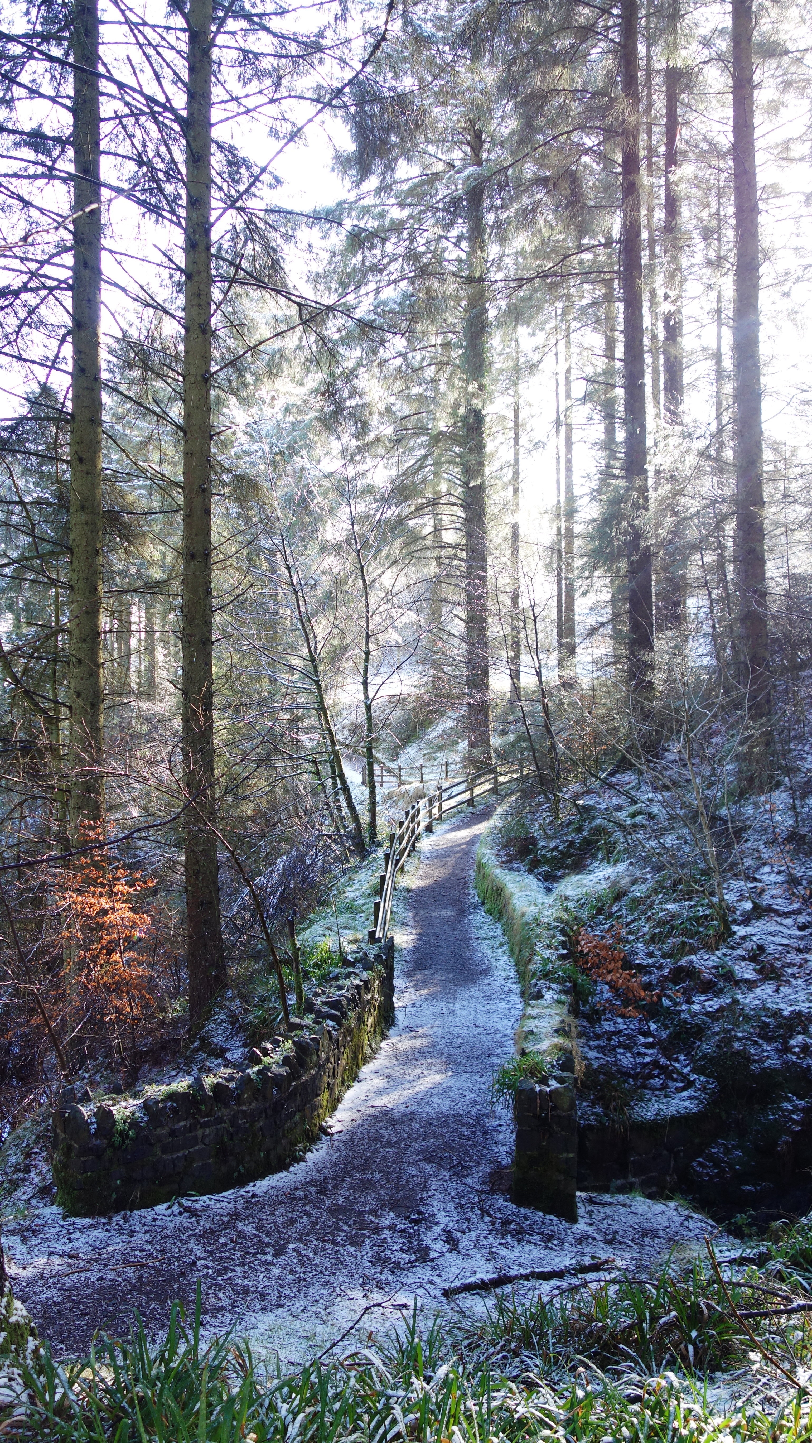
After finding the road sign for the “Slieve Croob Scenic Loop” (look for the brown coloured signs near Castlewellan) I turned off the main road and headed off onto (what became) a track not much wider than my car at times. I think this wasn’t helped by a fall of snow up there, with much of it still piled at the side of the route. That said, the views were stunning over the snow dusted valley.

slieve croob (4) slieve croob (5)

Slieve Croob meaning “mountain of the hoof” is the tallest of a group of peaks in the middle of County Down. These peaks lie north of the Mourne Mountains, between the village of Dromara and the town of Castlewellan. Slieve Croob has been designated an Area of Outstanding Natural Beauty. It is the source of the River Lagan, which starts as a spring and runs from here, through Dromara, Dromore, County Down, Lisburn and Belfast, where it enters Belfast Lough.

Folklore tells that 12 kings are buried at the top of the Mountain and each year it is traditional to climb the hill on the first Sunday in August (known as Cairn Sunday or Blaeburry Sunday) and carry with you a stone to help bury the kings. In recent times there is traditional Irish music played at the top of the Mountain on this date.

slieve croob (2)

A sheep thankful for his wooly coat at Slieve Croob.

legananny (1)

A dolmen, also known as a portal tomb, portal grave or quoit, is a type of single-chamber megalithic tomb, usually consisting of two or more upright stones supporting a large flat horizontal capstone (table), although there are also more complex variants. Most date from the early Neolithic period (4000 to 3000 BC). Dolmens were typically covered with earth or smaller stones to form a barrow. In many instances, that covering has weathered away, leaving only the stone “skeleton” of the burial mound intact.

It remains unclear when, why, and by whom the earliest dolmens were made. The oldest known dolmens are in Western Europe, where they were set in place around 7000 years ago. Archaeologists still do not know who erected these dolmens, which makes it difficult to know why they did it. They are generally all regarded as tombs or burial chambers, despite the absence of clear evidence for this. Human remains, sometimes accompanied by artifacts, have been found in or close to the dolmens which could be scientifically dated. However, it has been impossible to prove that these archaeological remains date from the time when the stones were originally set in place. Dolmens have also been found in Korea, Spain, and India.

legananny (2)

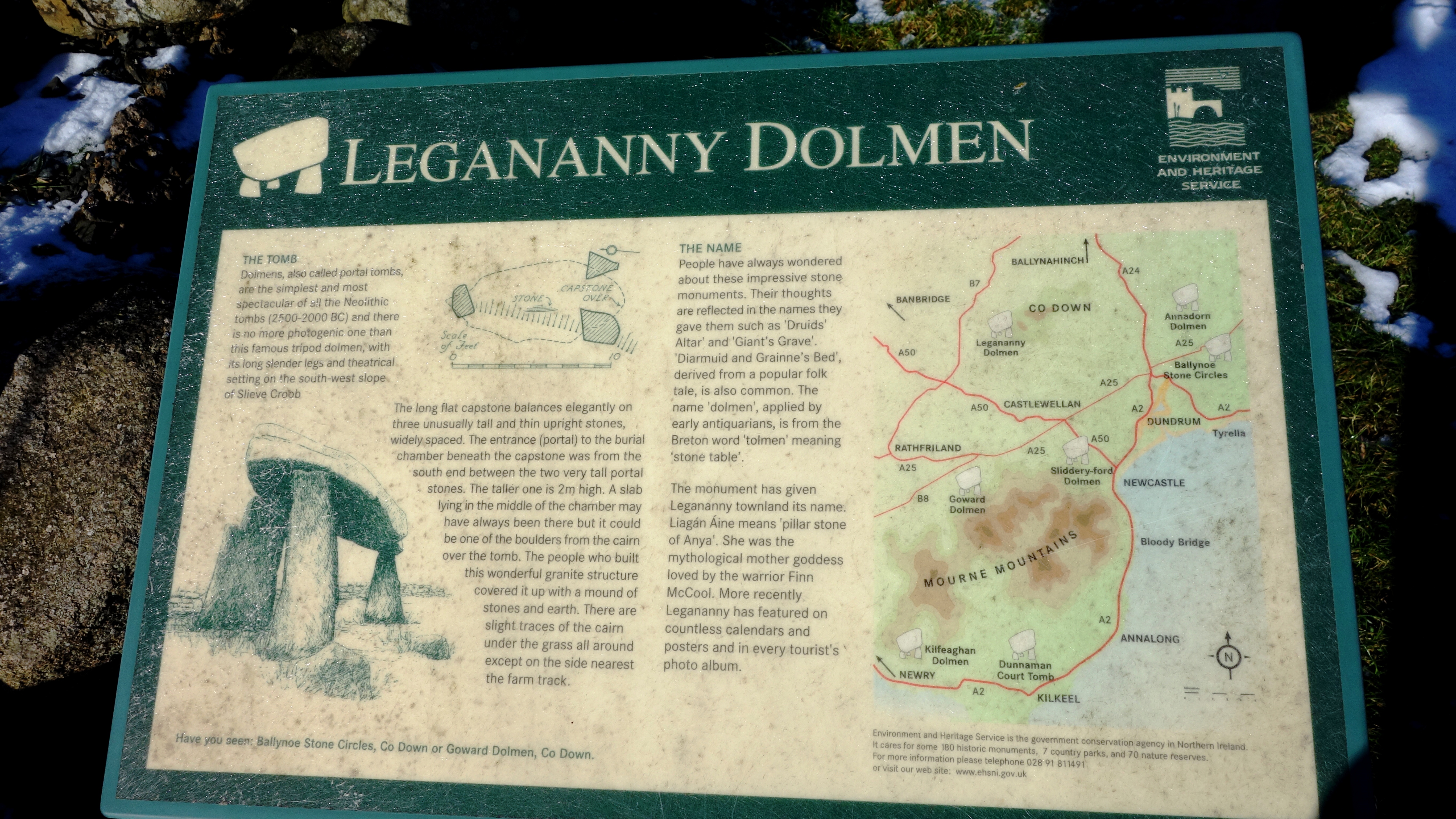
Legananny Dolmen sits up a lane behind a farmers house (its ok to walk up and see it without asking permission) and its astounding how this thing has sat here for so long. Im sure it would have some stories to tell based on what its seen for 5 millennia. Its so great to see these remnants of Irelands older non-christian history, and hopefully they shall remain for many more 1000s of years to come. Though given that some (apparent) Christians recently pulled down a monument at Gortmore, putting a cross in its place saying “You shall have no other Gods before me” then who knows. Story: http://www.londonderrysentinel.co.uk/news/local-news/manannan-mac-lir-pagan-priest-says-statue-theft-a-hate-crime-1-6543319 a Facebook campaign has now begun to try and replace it.

legananny (3) legananny (4)

Legananny Dolmen is a megalithic dolmen three miles north of Castlewellan, in County Down. It is on the slopes of Slieve Croob near the village of Leitrim, nestled between a farmer’s stone wall and a back road. It is a State Care Historic Monument. This tripod dolmen has a capstone over 3m long and 1.8m from the ground. It dates to the Neolithic period, making the monument approximately 5,000 years old. Such portal tombs were funerary sites for the disposal of the dead in Neolithic society. The heavy stones would have been dragged some distance before being set in place. The three supporting stones are unusually long and some ancient urns were found underneath. The name Legananny is believed to be derived from Irish Liagán Áine, meaning “Áine’s standing stone” – Áine being an Irish goddess.

windy gap (1)

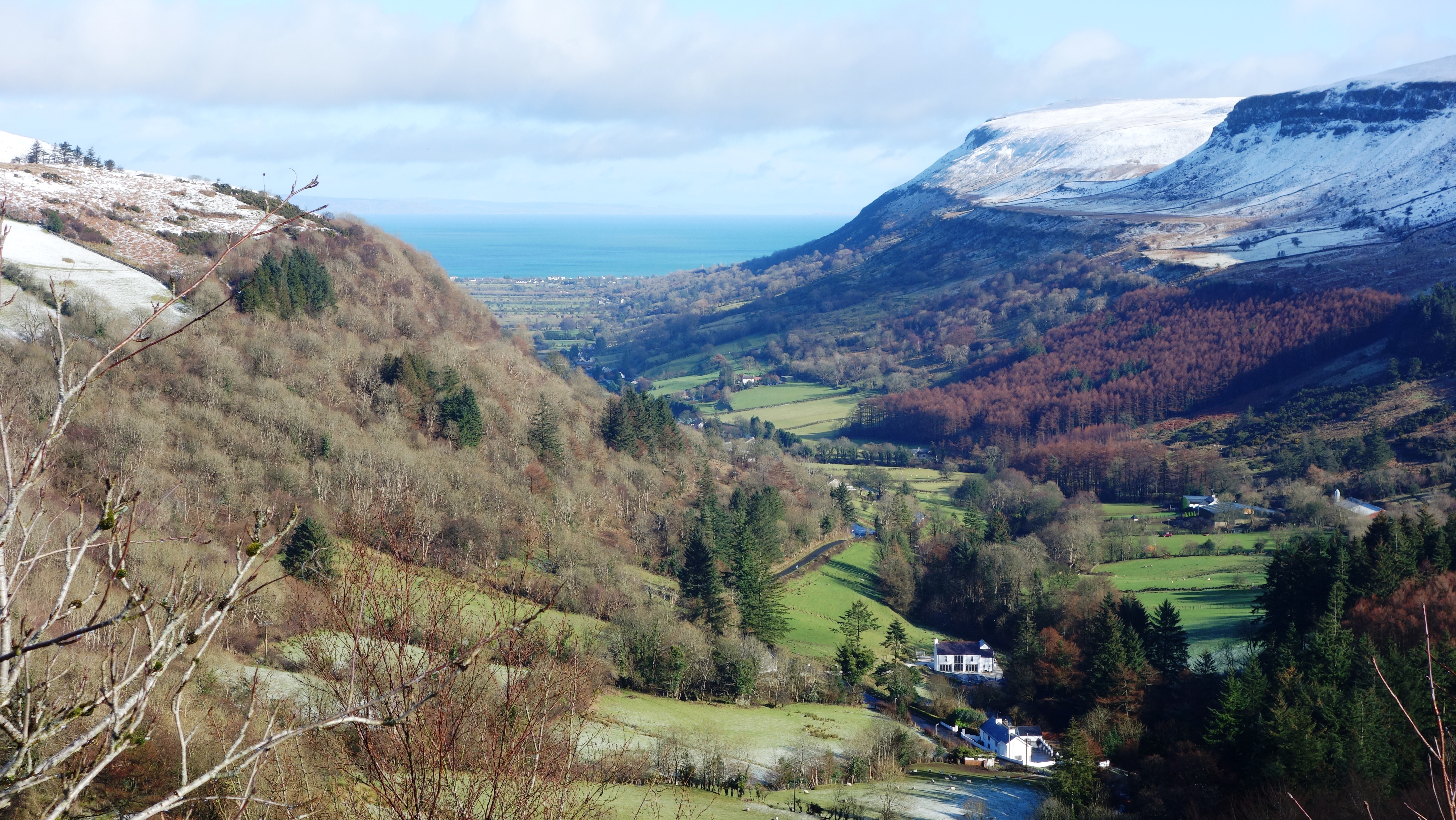
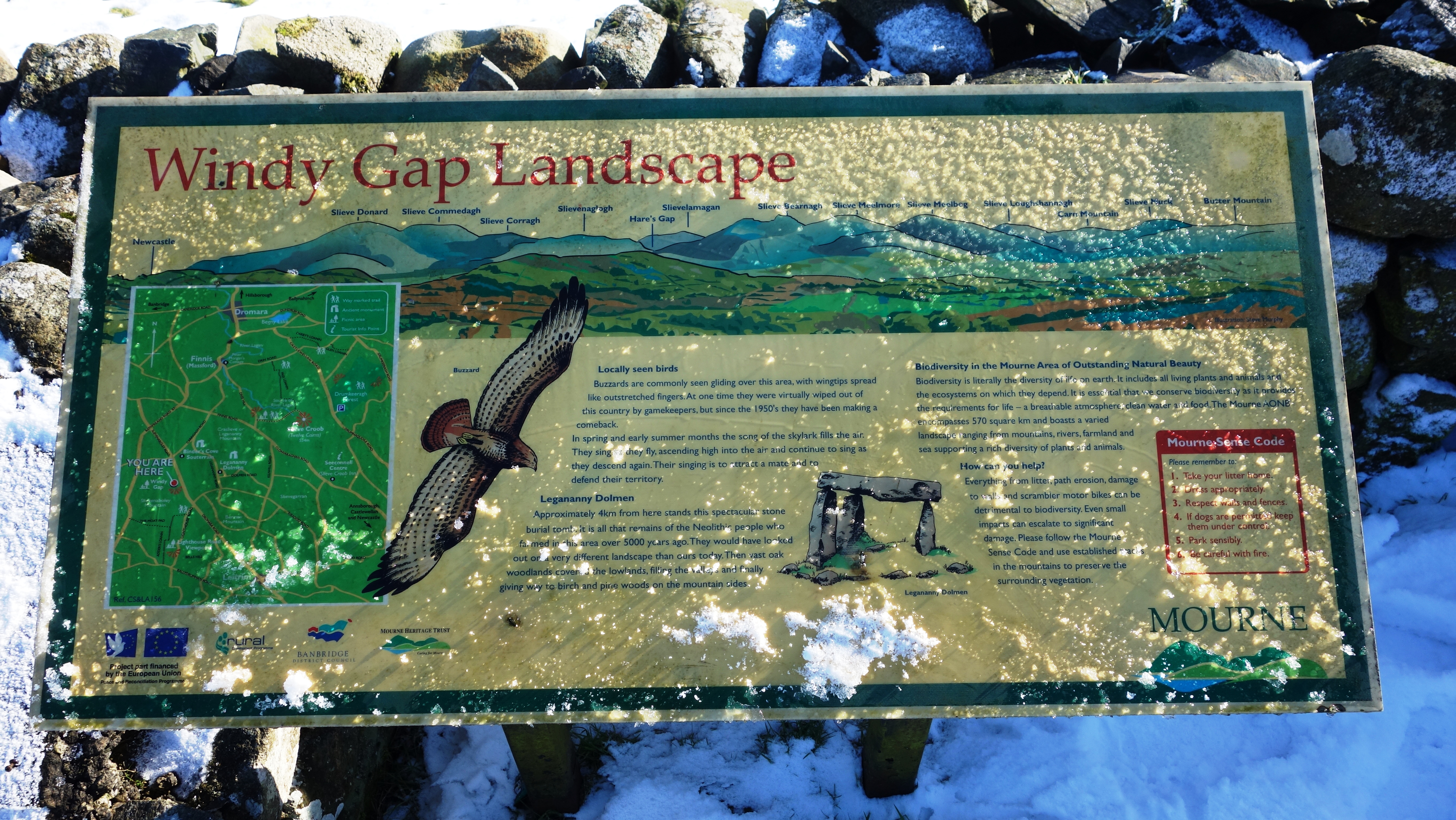
After leaving Legananny I drove on a few kilometers and parked at the car park at Windy Gap (hmm, I reckon not too much thought went into that one lol).

windy gap (2) windy gap (5)

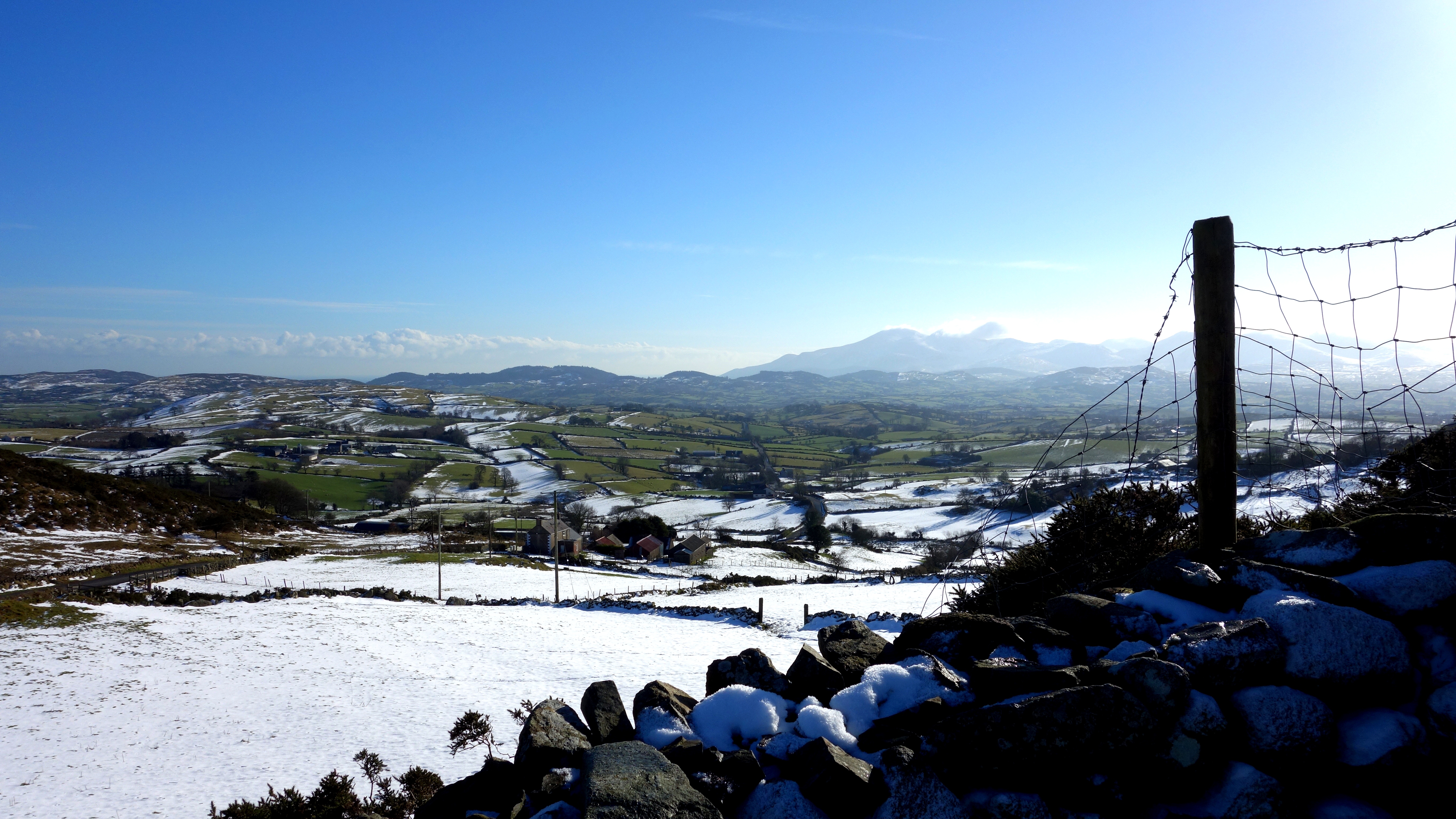
The view was beautiful (and actually it wasn’t windy at all) and in the second picture here you can see (almost) the entire Mourne Mountain range in the distance.

windy gap (3)

No picnics today at Windy Gap. Brrr!

windy gap (4)

A far off glimpse of the highest peak in Northern Ireland, Slieve Donard, with a little wisp of cloud caught on the top. Once again, I explored (marvelously) alone that morning and if you visit NI you really should hire a car and get away from the obvious tourist traps like the Titanic Quarter and Black taxi mural tours etc. We have so much more to show you than those things!